The first night on the boat was a short one. I couldn’t sleep very well and for some mystical reason I had booked breakfast at seven. 7 a.m. When I had a whole day to kill. The breakfast was….food uptake, not more. I spent some hours in the cabin watching TV or dozing on the bunk bed. I had lunch in the fancy restaurant again, two different sandwiches this time. The Faroese snaps was different, but I liked it a lot (Haviđ, 50 %). I spotted it in the boat shop so I think on the way back I will stuff some in my panniers.
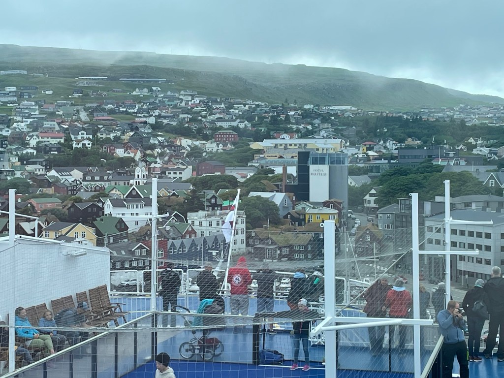
I dozed a bit more in the cabin and moved to the panoramic deck as we would soon make a stopover in Torshavn, the capital of the Faroe Islands. I hoped that I could pick up a 4G internet signal and upload the report of yesterday. I received a message from my provider that I would be charged a daily roaming pass. No problem. However, in a second message I was told that my credit was zero and I couldn’t buy the pass.
When we left the day before, I sent a few pictures, and as the ship’s wifi did not allow any uploads, I did it with a 4G connection that I believed to be from the Danish mainland. However, I was probably the ship’s 4G network which usually charges a fortune per Mbyte. Within seconds, my credit was evaporated and I was not able to re-charge my credit. Remember, bad upload speed. All of this got crystal clear to me when I could not connect to the Faroese network. I tried and tried to charge the account – until it finally went through! I was connected to the Faroese 4G and could upload the post.
After the boarding of new passengers, we continued the crossing through the Island. Suddenly, the fog lifted and enjoyed a fantastic scenery: steep fjells and little fjords, some spectacular views.

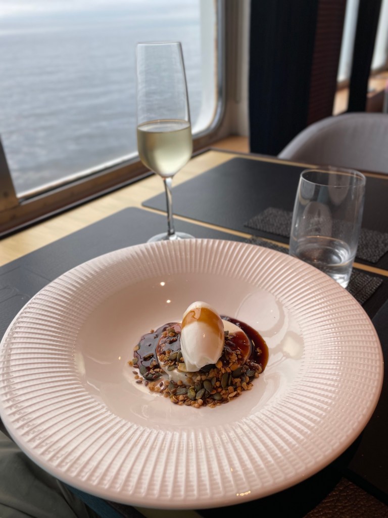
Just when we were leaving the last rocks, it was time for my pre-booked five-course in the fancy restaurant, accompanied by a matching wine selection. It was actually quite good, considering I was on a ferry boat. Yummy.


We had to do the passport and COVID test controls by the police on the ship that evening, but seeing the long queue, I decided to watch some news first and come back later. I met Henry and Bodo, the two lads from the boarding queue and we spent the evening together. The checks went quite smooth and we received a green voucher that should substitute the border control.
We went to the lounge and had a couple of beers together, only molested by the solo entertainer that made a conversation difficult.
To my surprise, I didn’t have a heavy head the next morning when I strolled to the breakfast. Everybody had to leave the cabins at 8 a.m., so I tried to have a nap in my gear in the corridors. Finally we were granted access to the car deck and I unstrapped my bike. The other motorbikes still seemed to be in a Zen mode, so I was the first biker to leave the ship. There was indeed no passport control and I entered the little town of Seyđisfjörđur.
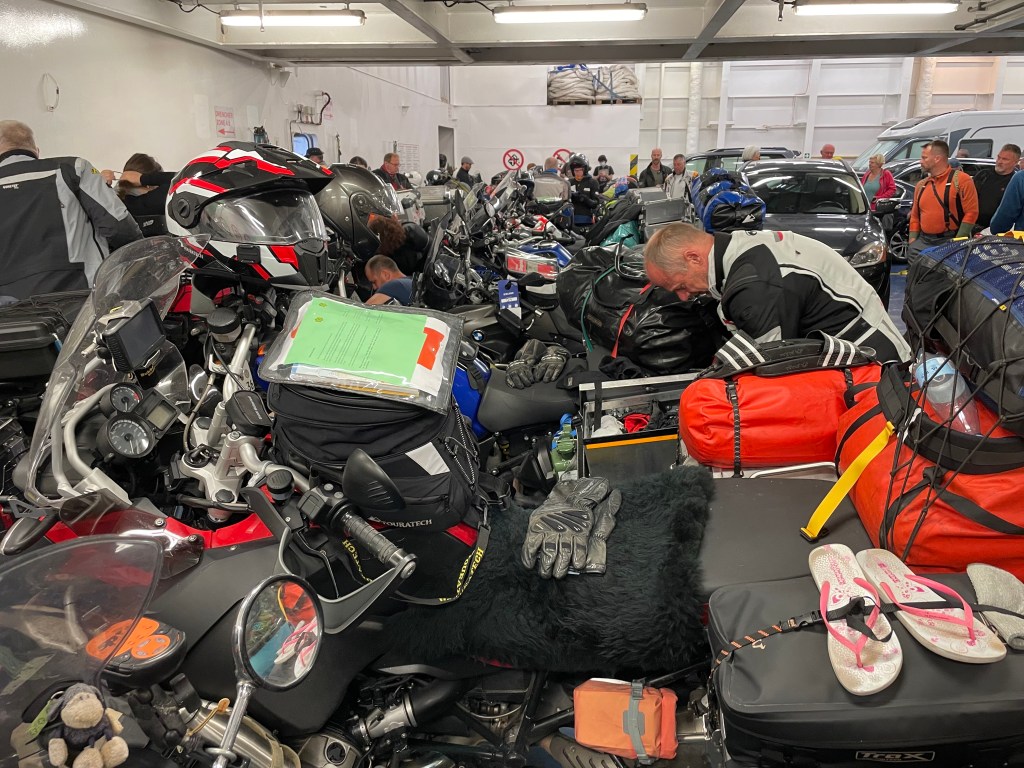
To my surprise, I didn’t have a heavy head the next morning when I strolled to the breakfast. Everybody had to leave the cabins at 8 a.m., so I tried to have a nap in my gear in the corridors. Finally we were granted access to the car deck and I unstrapped my bike. The other motorbikes still seemed to be in a Zen mode, so I was the first biker to leave the ship. There was indeed no passport control and I entered the little town of Seyđisfjörđur.

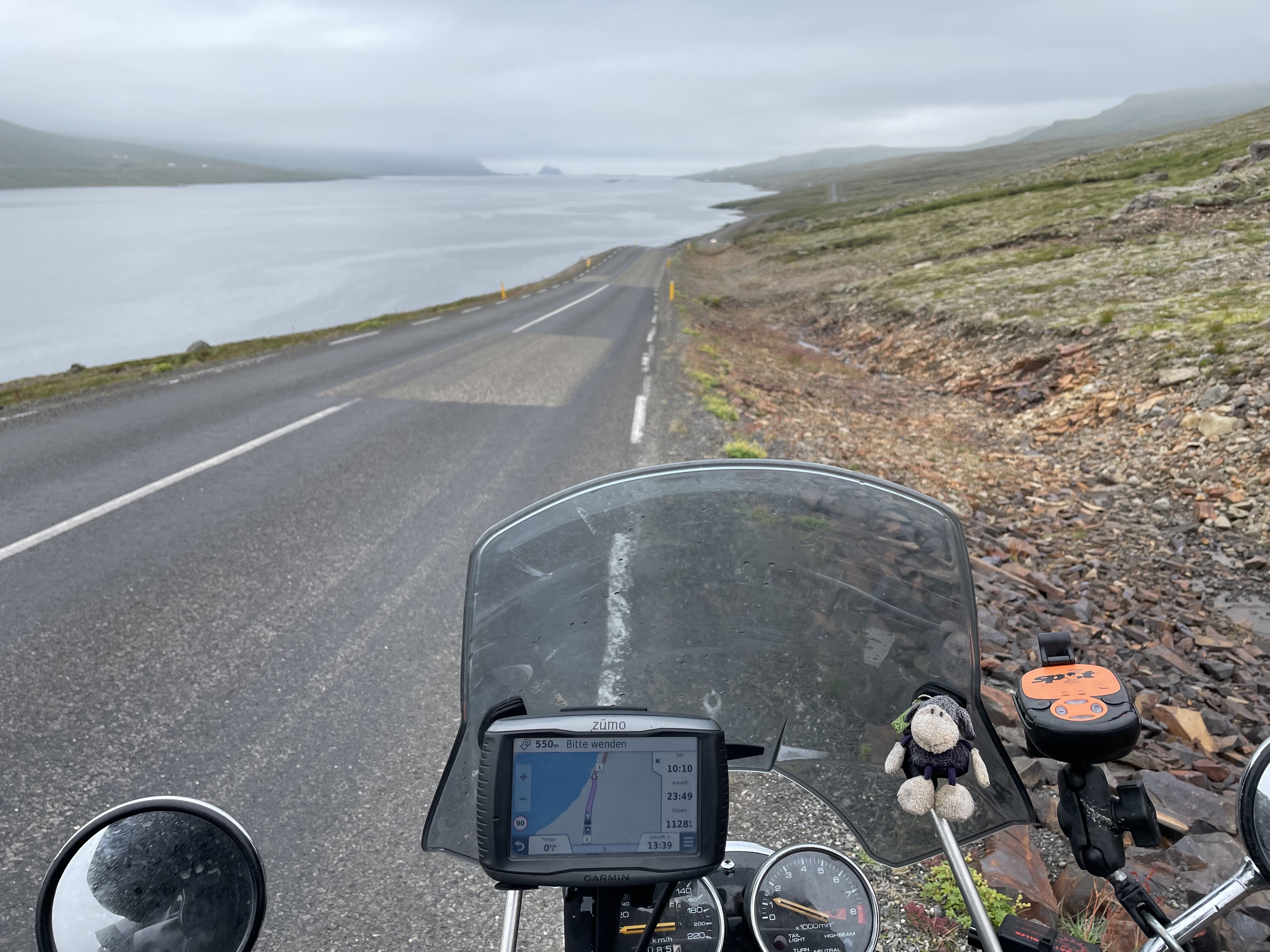
The weather was as expected: cool 11 degrees, foggy with a light drizzle. I started my trip around Iceland! It was a slow start. The surface was wet and I needed to get used to the tarmac, it was very rough and felt it there was some gravel on the road. Most of the time there wasn’t any, but sometimes yes. The road moved upwards into the clouds. I apparently passed a fjell at 500 m and the temperature dropped to 8 degrees. Cozy. In Egilsstađir I turned onto the Route 1, the ring road around Iceland. I encountered a gravel section…how long would this take? The gravel was deep…I learned later that sometimes there are stretches of gravel that is rolled into a dense surface. In this case, the gravel had not been rolled yet…
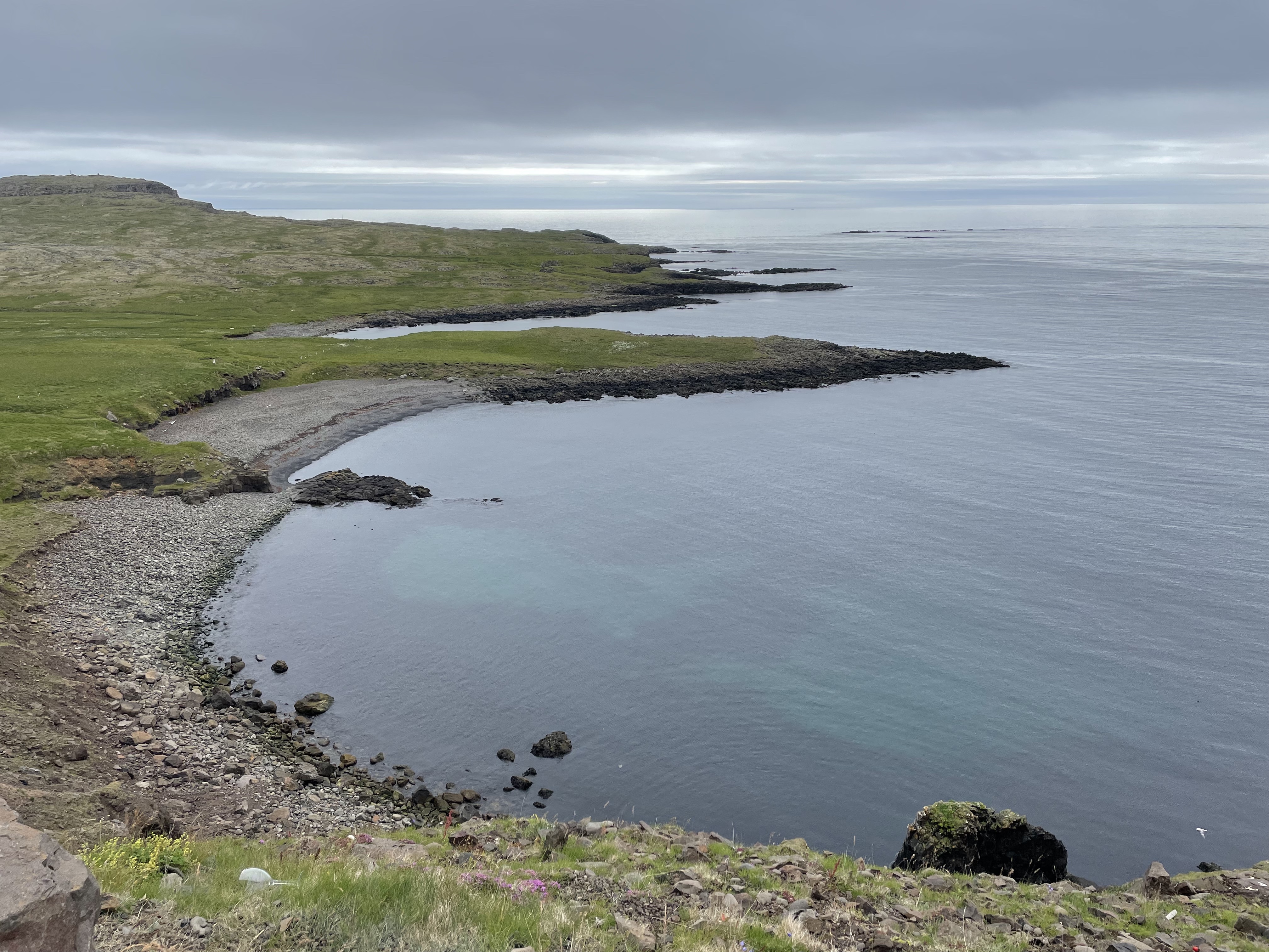
In the next three hours, I rode through the Eastern fjords, occasionally stopping to take a picture. The problem was to capture the atmosphere on the photos, which was almost impossible, in reality, the landscape was often impressive. Slowly, the temperature increased from 11 to 13 degrees, but I could feel the cold creeping in. This was the real thing now – no fairing, no heated grips, no heated seat, no heated gear – just the fresh wind and I. I realized how much I was spoiled in the last years through the big bikes.


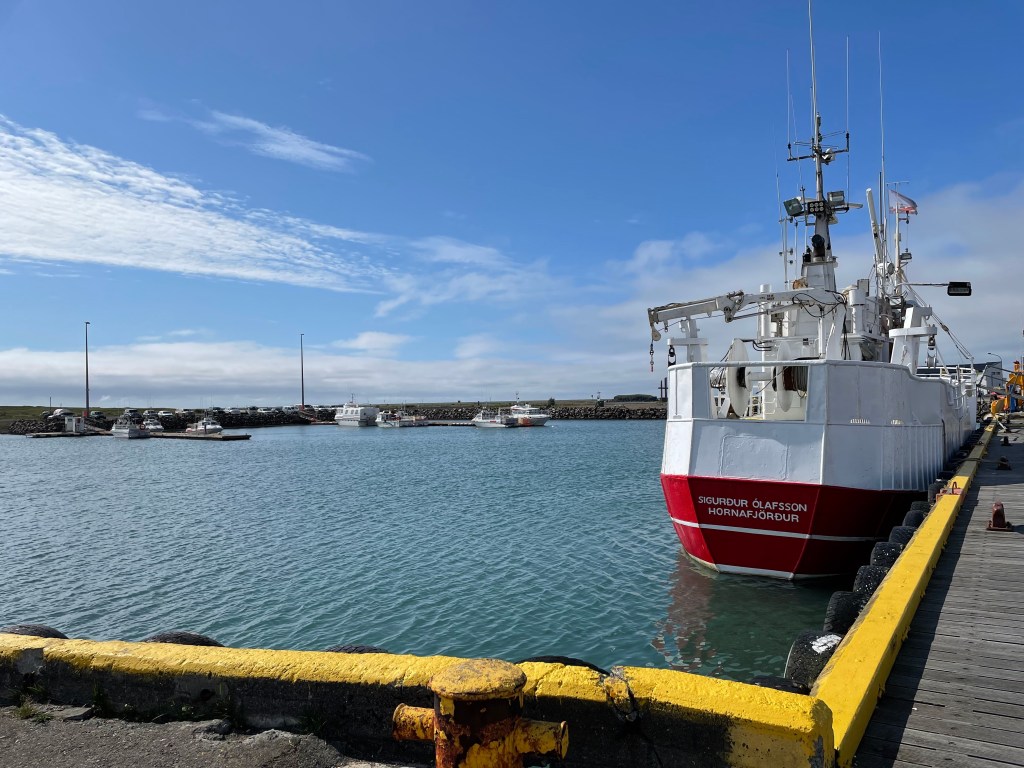
After 280 km, I arrived in Höfn, the largest town in the southeast. Finally the sun penetrated the clouds and temperature rose to 14 degrees. I filled up the bike, but didn’t find a compelling option to have lunch. I ordered a hot sandwich in a petrol station and tried to get warm again, it was quite chilly.
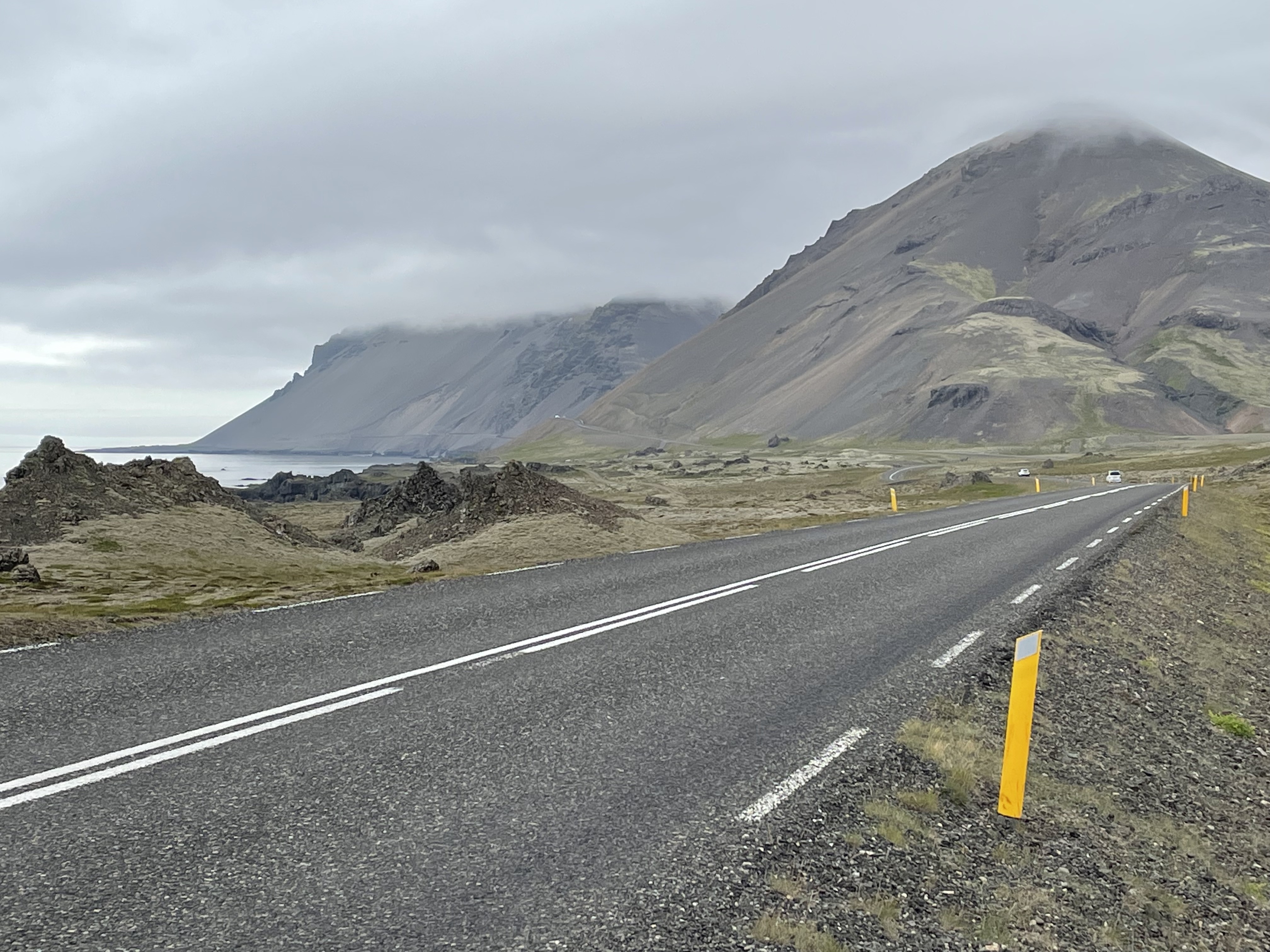
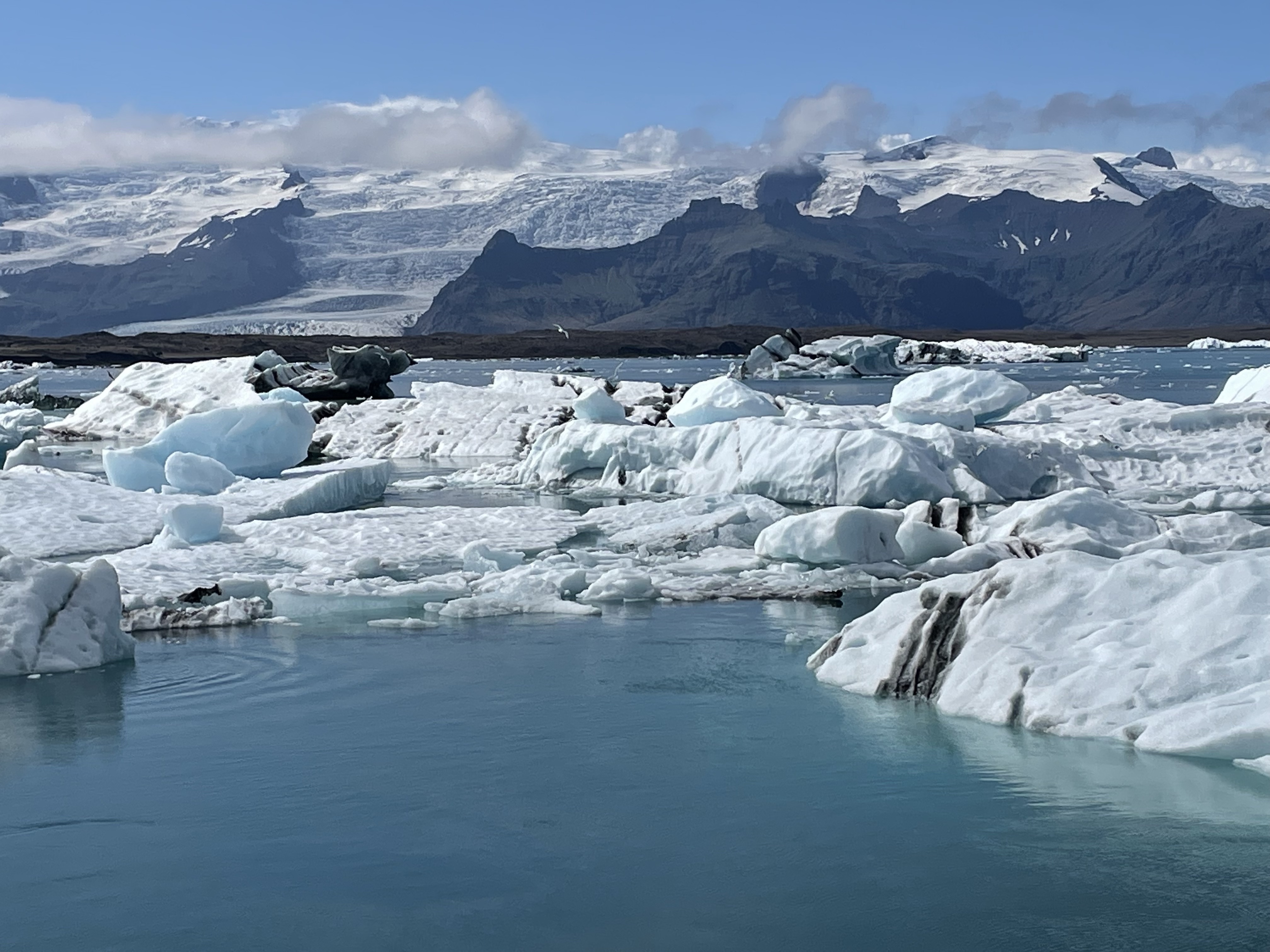
I adapted my riding style to the locals, there were more and more cars and the speed rose. The landscape changed, but in a spectacular way; I approached the Vatnajökull glacier. I could only see some individual glacier tongue, but the sheer size is hard to grasp.
With an area of 7,900 km²,Vatnajökull is the largest ice cap in Europe by volume (about 3,000 km³) and area (not counting the still larger Severny Island ice cap of Novaya Zemlya, Russia, which may be regarded as in the extreme northeast of Europe).
The average thickness of the ice is 380 m (1,250 ft), with a maximum thickness of 950 m (3,120 ft). Vatnajökull has around 30 outlet glaciers flowing from the ice cap.
Wikipedia
Finally, I spotted the first glacier tongues; the white ice cap was shining in the distance. This was genuinely a beautiful sight.
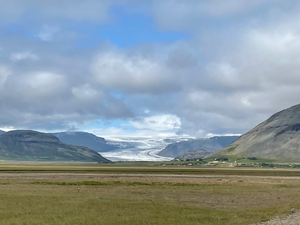


The weather forecast was spot on! This turned to be a nice day with temperatures up to 17 degrees.
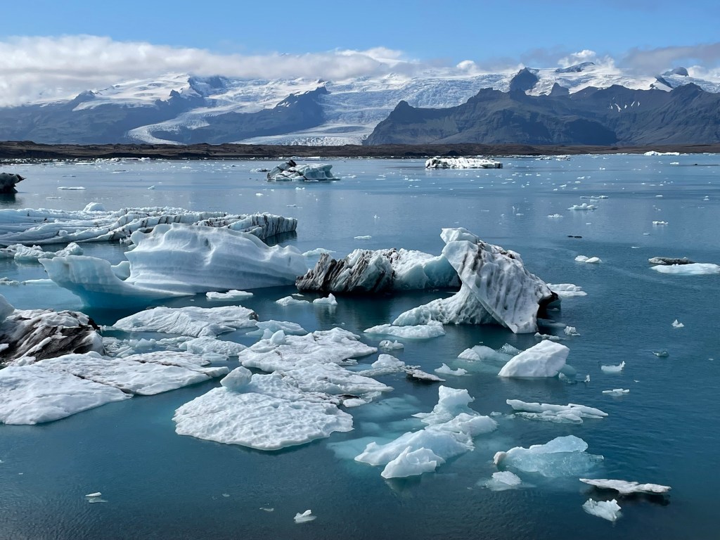
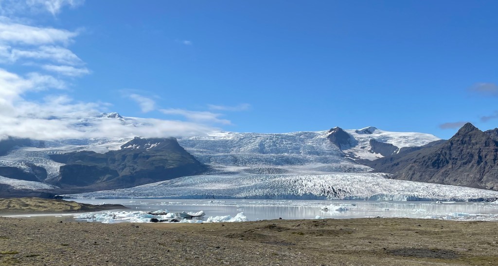
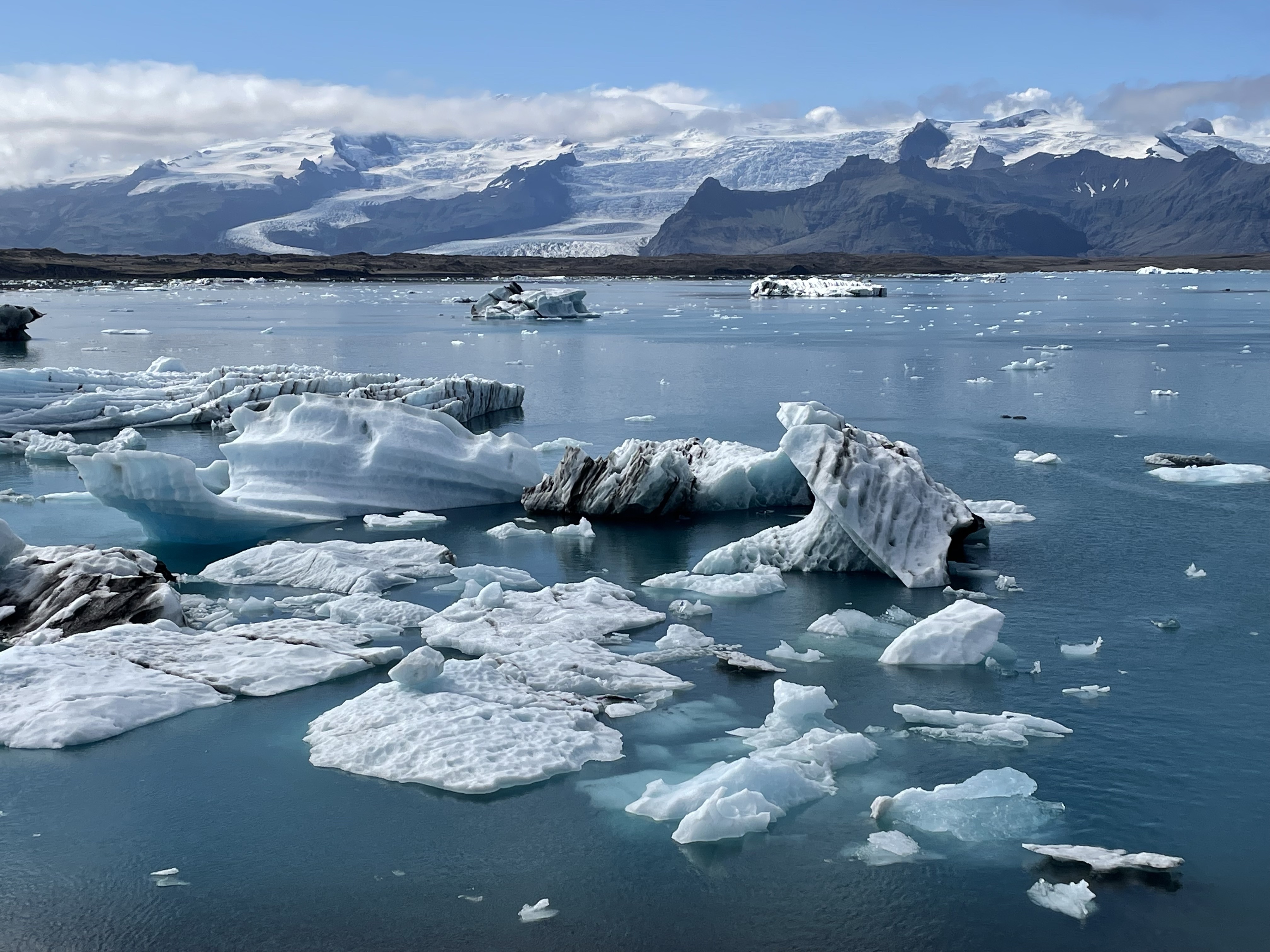
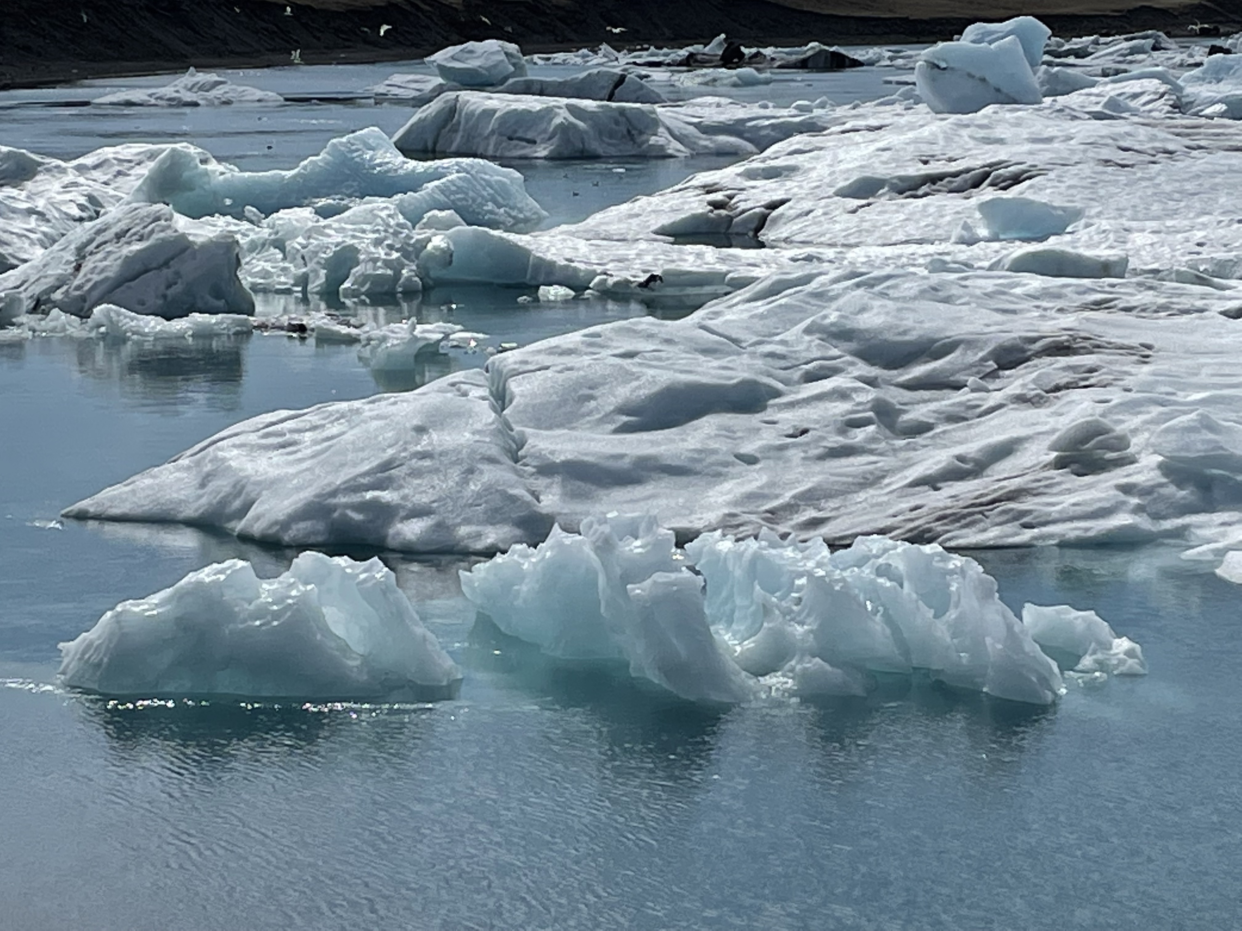
Finally I arrived at the Highlight of the day, the Jökulsárlón, a glacier lake like no other.
Jökulsárlón (Icelandic pronunciation: [ˈjœːkʏlsˌaurˌlouːn] (listen); literally “glacial river lagoon”) is a large glacial lake in southern part of Vatnajökull National Park, Iceland. Situated at the head of the Breiðamerkurjökull glacier, it developed into a lake after the glacier started receding from the edge of the Atlantic Ocean. The lake has grown since then at varying rates because of melting of the glaciers. It is now 1.5 km (0.93 mi) away from the ocean’s edge and covers an area of about 18 km2 (6.9 sq mi). In 2009 it was reported to be the deepest lake in Iceland, at over 284 m (932 ft). The icebergs that calve from the glacier edge move towards the river mouth and get entrenched at the bottom. The movement of the icebergs fluctuates with the tide currents, as well as being affected by wind. However, they start floating as icebergs when their size is small enough to drift to the sea. These icebergs are seen in two shades: milky white and bright blue, which depends on the air trapped within the ice and is an interplay of light and ice crystals.
wikipedia
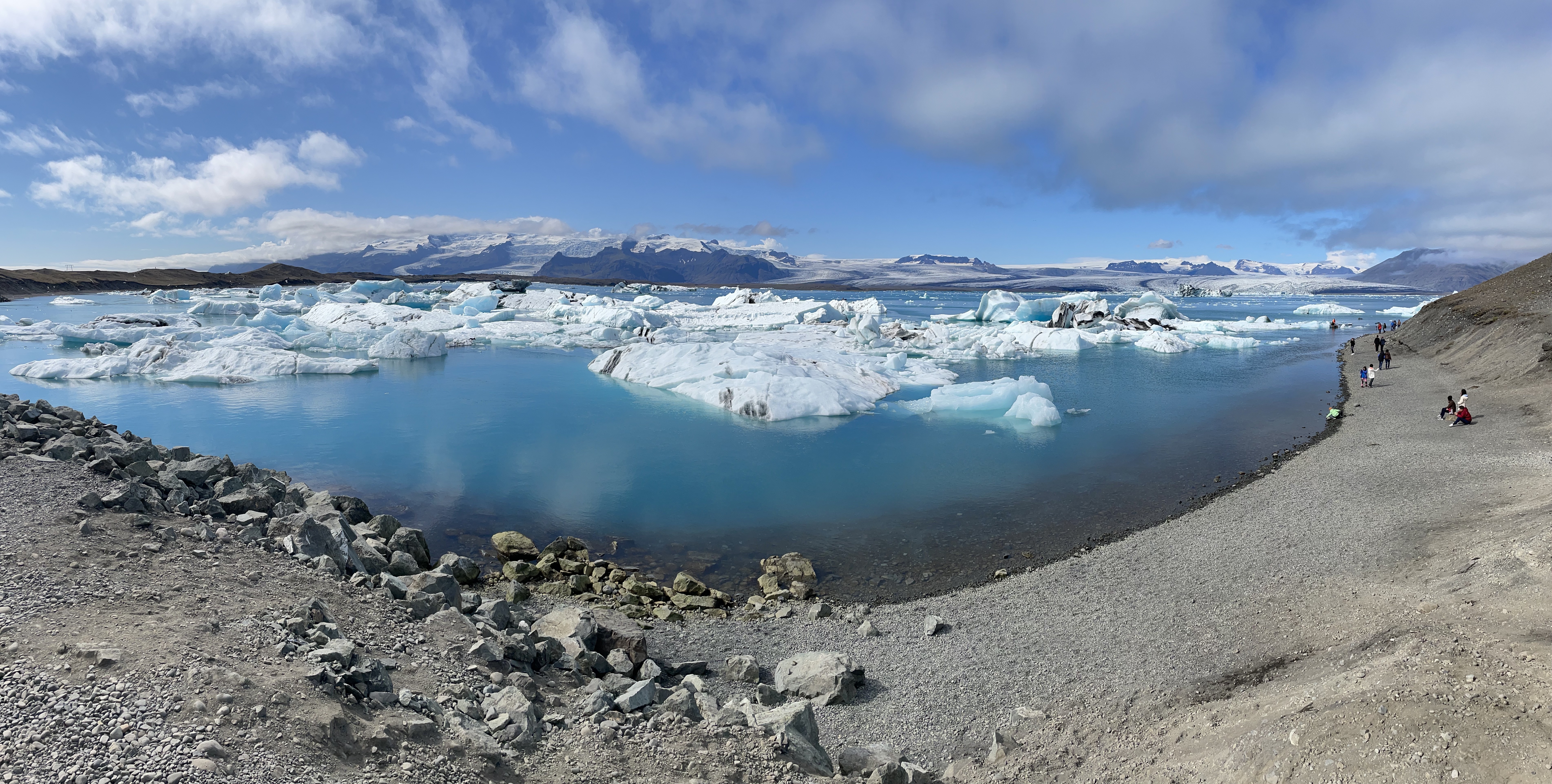
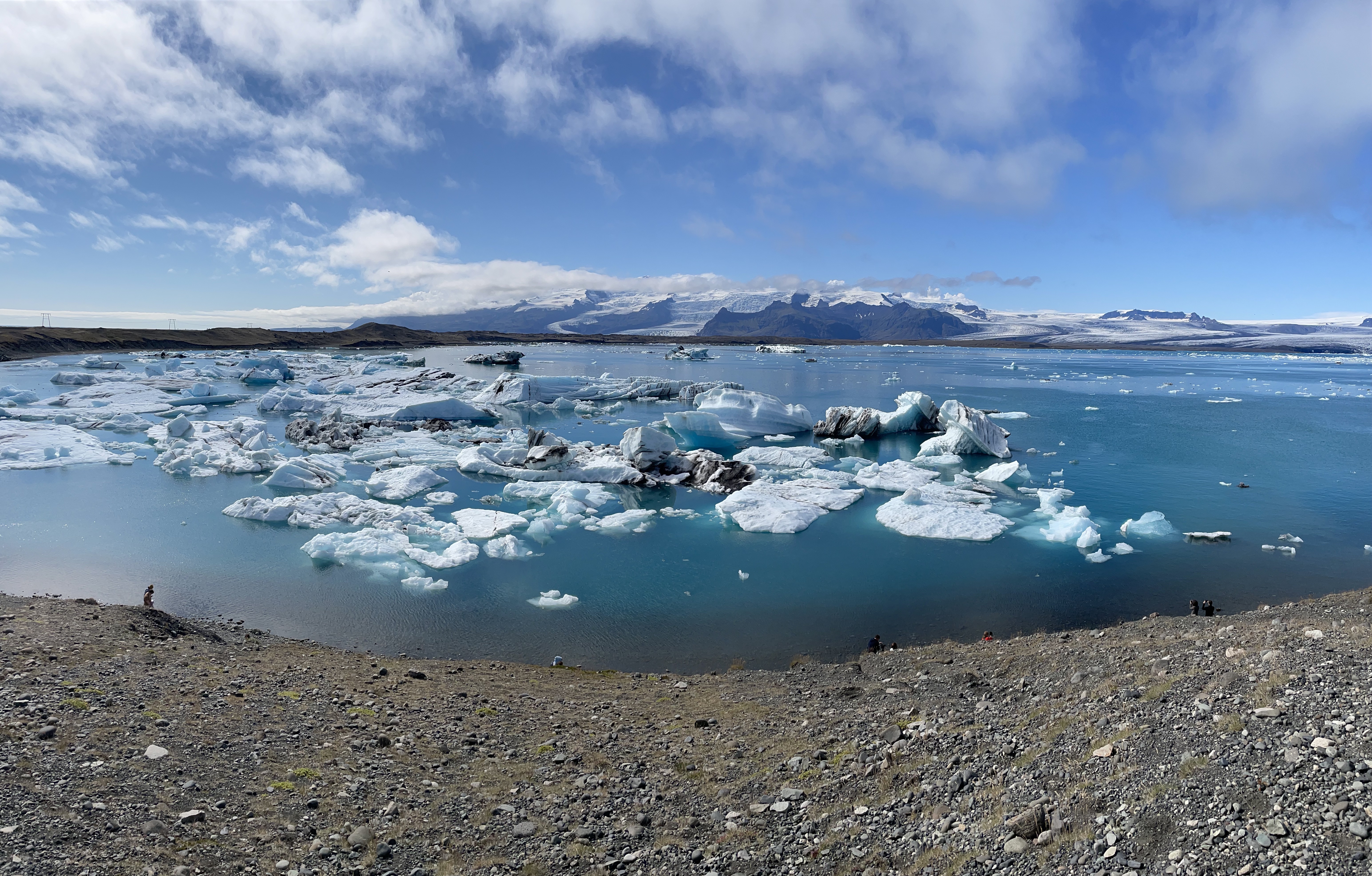
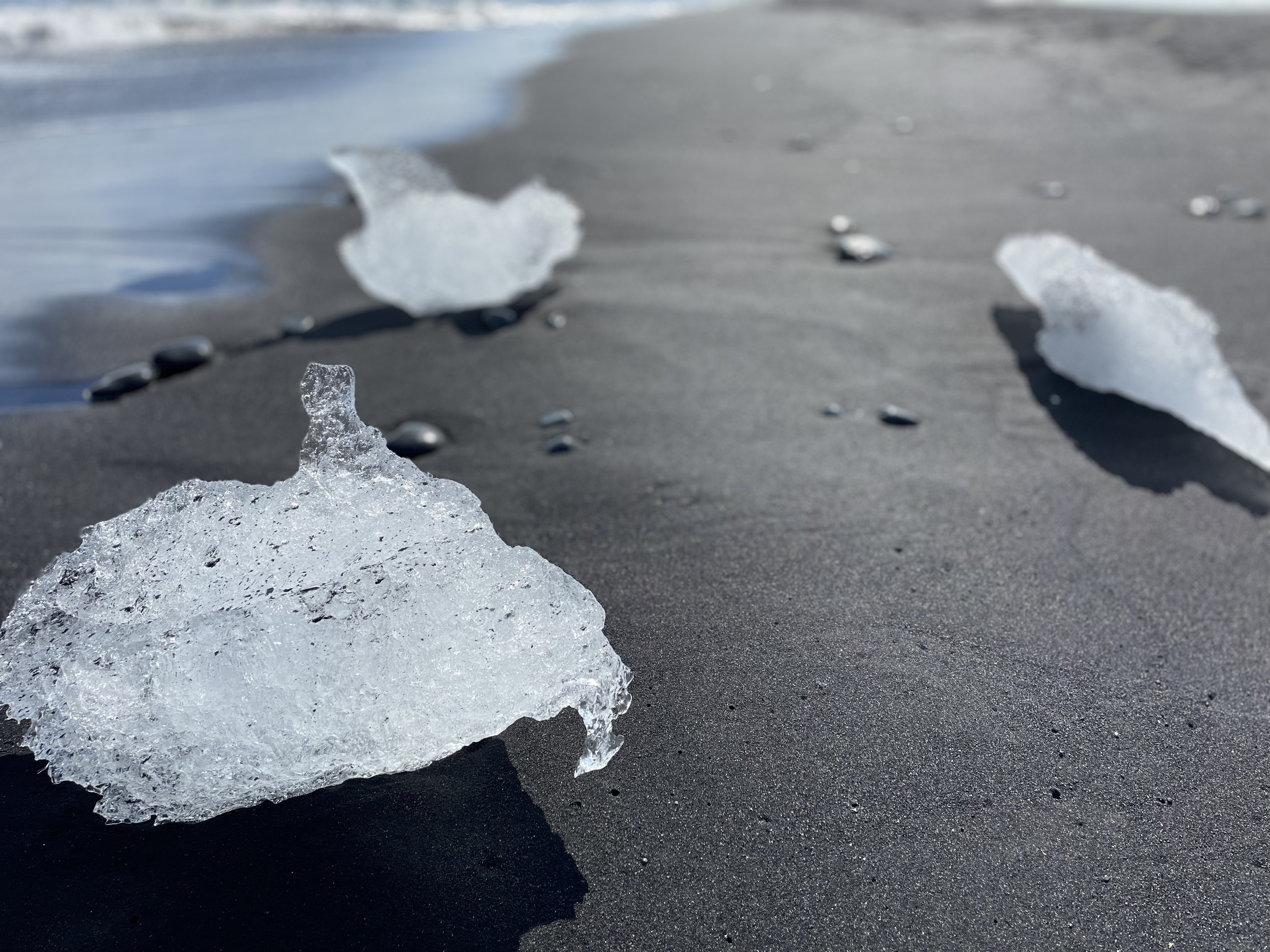
Of course it’s a tourist magnet and the top location in Southern Iceland. On the other side of the road, there is the second attraction of the location, the DIAMOND BEACH.
The river Jökulsá connects the lagoon to the Atlantic Ocean, meaning that these icebergs eventually drift out to sea where they are polished by the waves before floating back to the black sands of Breiðamerkursandur. The name ‘Diamond Beach’ thus comes from the white ice on the black sand appearing like gemstones or diamonds, as they often glisten in the sun.
As there was high tide, there were only few icebergs on the black beach, but this is still a great sight.


The massive amounts of melted water was transported in large rivers to the sea.
The rest of the was dominated by one gorgeous view after the other, when I had passed the Vatnajökull, the landscape changed and the lofty small green mountains returned.

And then again the landscape changed. A lot of rocks, but covered by a huge amount of Iceland moss!
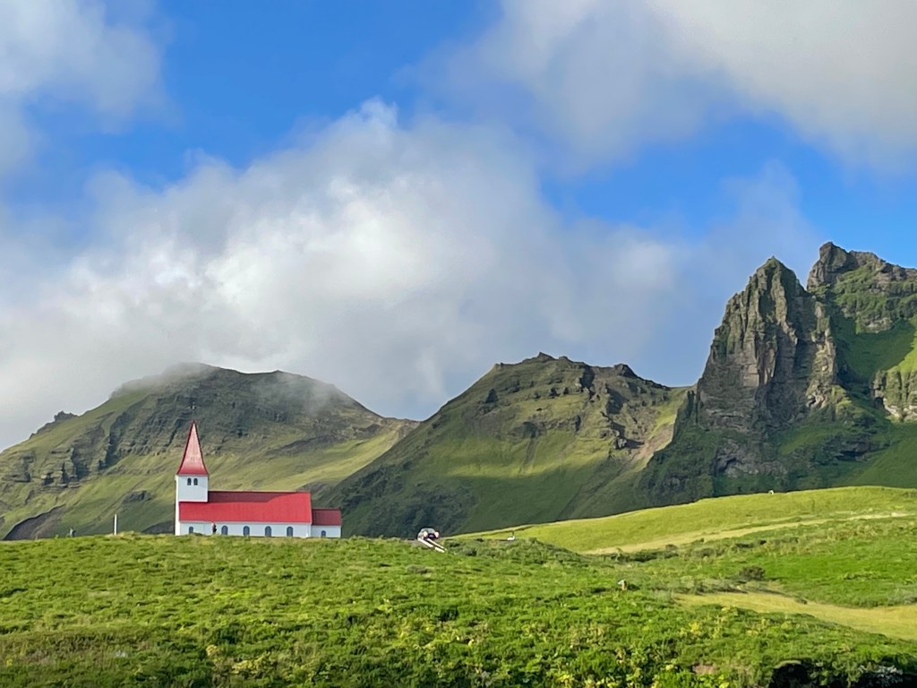
And finally, after 560 km, I reached Vik í Myrdal, the southernmost town in Iceland. I filled up and went around the big rock that dominates the town.
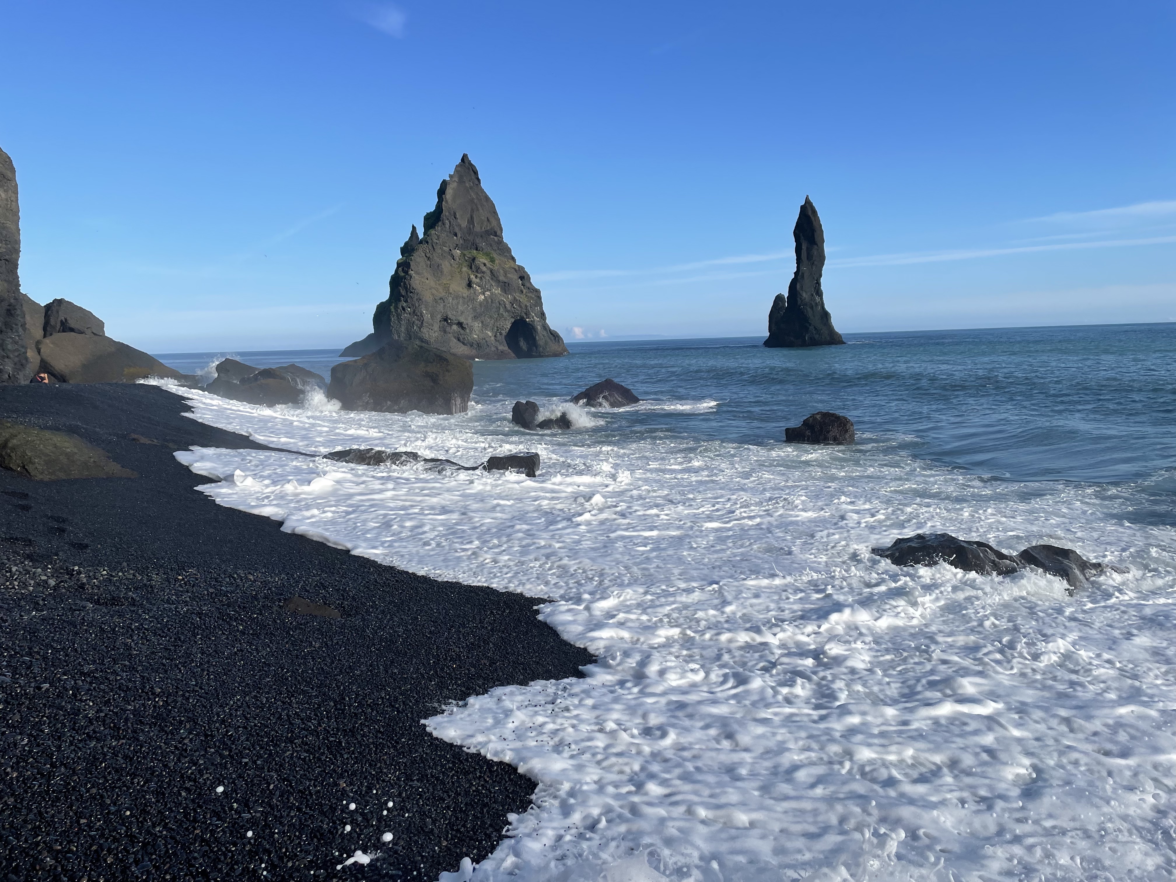
This is other of Iceland’s highlights: Reynisdrangar
Reynisdrangar (Icelandic pronunciation: [ˈreiːnɪsˌtrauŋkar̥]) are basalt sea stacks situated under the mountain Reynisfjall near the village Vík í Mýrdal in southern Iceland. It is framed by a black sand beach that was ranked in 1991 as one of the ten most beautiful non-tropical beaches in the world.
Legend says that the stacks originated when two trolls dragged a three-masted ship to land unsuccessfully and when daylight broke they became needles of rock.
wikipedia
This is really an exceptional place, I let the pictures speak for themselves…


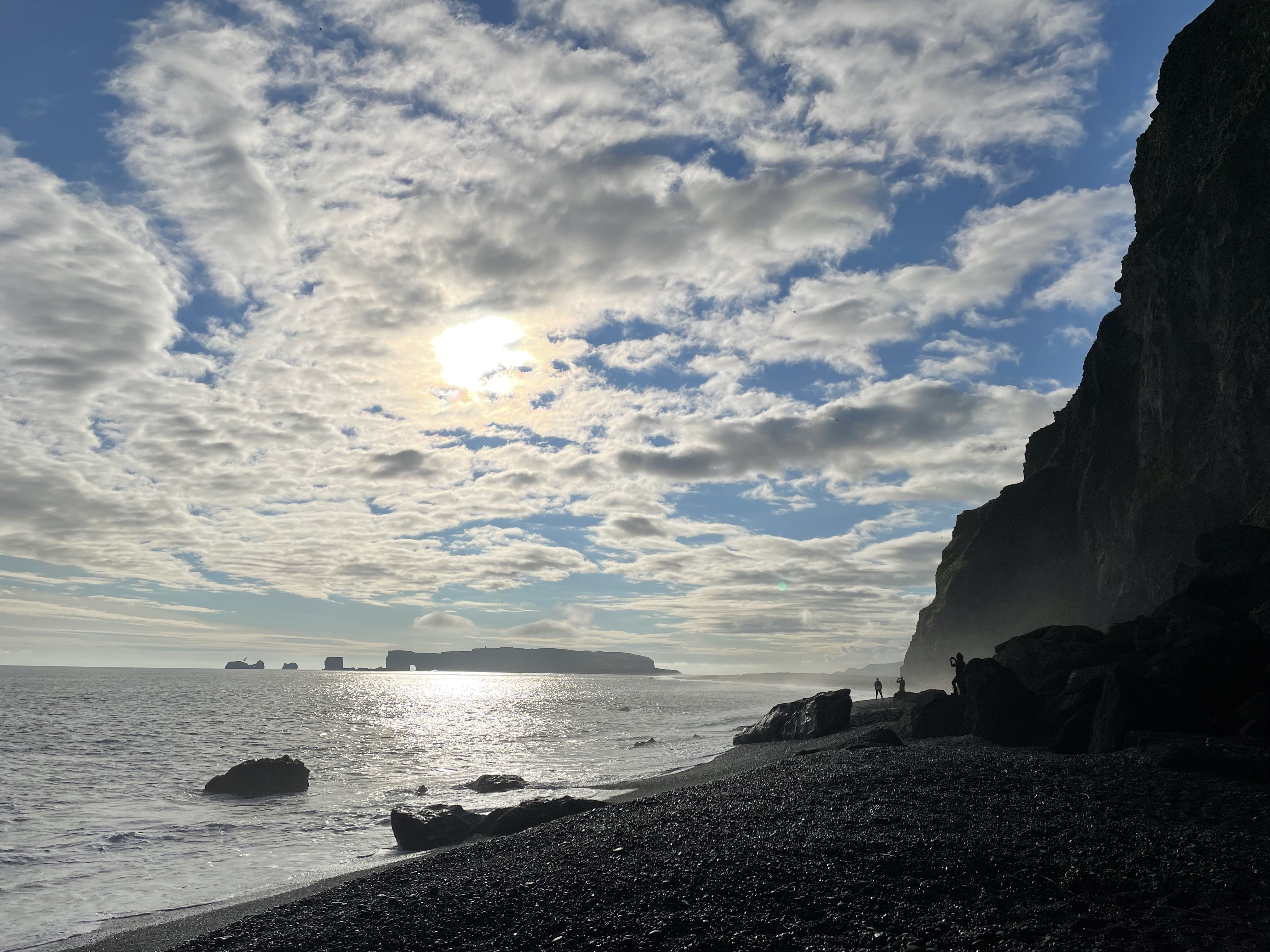
The hotel is only a few kilometers away, the evening sun illuminated the landscape like a painting:

I checked in, had a shower and went to the restaurant, the usual routine. I had a fish soup and a tasty lamb roast. Simple, but good. I think I was lucky to have such a sunny day today, Iceland showed its best side today. This day will be the largest section on the whole trip (580 km). Tomorrow it will be a shorter ride. But this first day was a very good start.

Leave a comment