
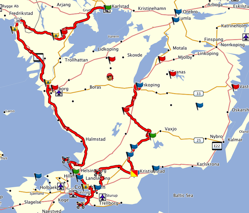
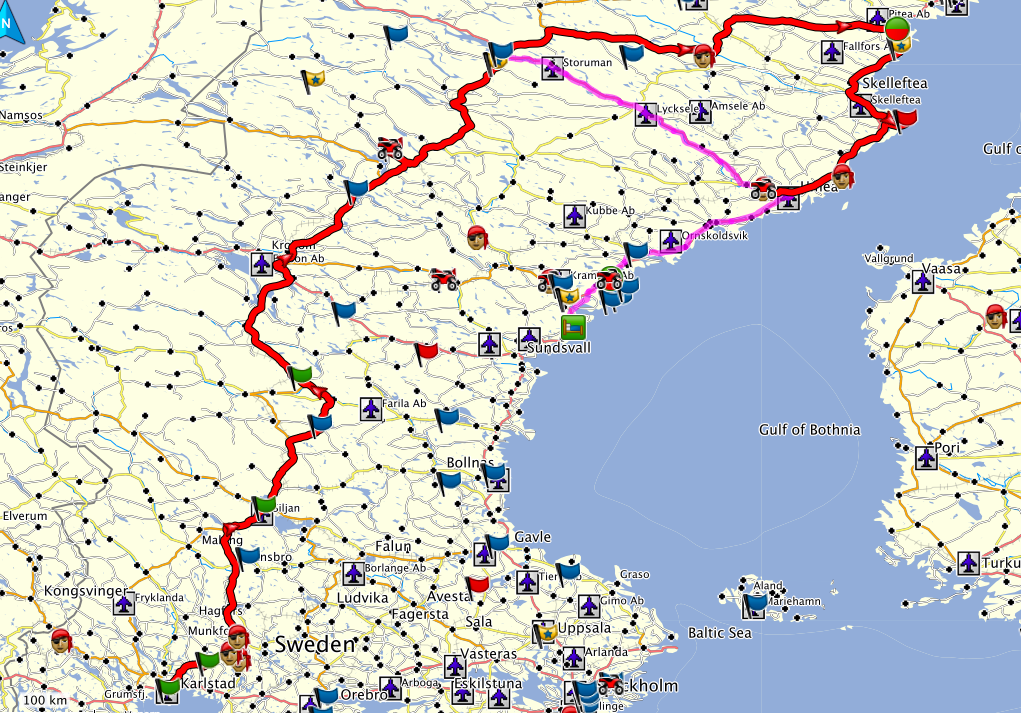
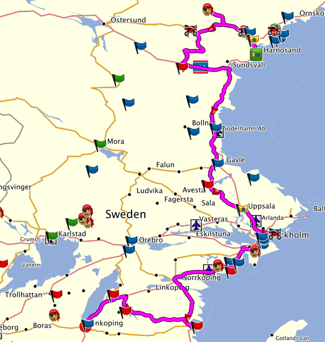
In the rider meeting, it turned out that this rally had a certain twist. In addition to the usual bonus points and some extra points for combos, there were also extra points for time spent on ferries and there were additional points for so-called “flexi-combos”. There were thematic categories, just like combos, but the more locations were visited, the more extra points could be achieved.This seemed familiar from the latest Brit Butt rallies. The thing was that these extra points were very high in relation to combos or normal location points. This meant that the flexi-combos had to be the backbone of any successful route. There were massive points for 4, 6, 8, 14 or 20 locations of one category. It was clear that 20 locations were not doable or requiring too much time. So doing one or more 14 points in a category would get 20.000 extra points each, that’s quite a lot when normal locations were in the range of 200 – 400 points. I was well prepared to take ferries across the Baltic sea, but it was obvious that despite the ferry bonus, there were not enough locations for flexi-combos over there. The tedious thing was that the locations of each of the flexi-combos were given in a gpx file and had to be imported individually into Basecamp. All 23 of them. I changed the symbols so I could better distinguish them in the bigger picture. And then I became aware of the key element of any good route here: some flexi-combos shared the same points! This meant that the challenge was to visit these points and build a route around them, ramping up the numbers in as much categories as possible. There was another important twist: apart from three documented rest break of four hours each, the participants had to return with three souvenirs purchased in three different countries in order to be a finisher. Tricky, because my first plan envisaged riding in Sweden only. The only options were Denmark and Norway, Finland seemed too far away. So I planned a stop in Copenhagen and just across the border on the Göteborg – Oslo highway where I went on that morning. I selected the two categories with the highest number of locations and added other categories to it. In the end, I had a route of planned 54 hours of riding time in the 60 hours window (72 hours minus 3 x 4 hours rest time). That seemed doable. I had included an option for a 3 hour extra loop to Luleå, but this was a decision for the afternoon of the second day. The plan was to do a loop in Southern Sweden, visit Copenhagen (buy souvenir), go up to the Norwegian border (buy souvenir) and go up North in central Sweden. Then turn to the coast and return to Jönköping. A solid, rather low-risk plan. I prepared my luggage and found some good night rest, as the start was only planned for 7:30 a.m. to 9:30 a.m. However, as I wanted to stay in Karlstad the next night, my plan suggested to leave early.

The next morning I left at 7:41 a.m. on a sunny morning. Weather forecast was nice for the first day, wet for the second day and sunny for the third day again. My first stop was not far away, but it gave me a glimpse what was ahead of me in this rally: I had to do a little walk to find the right plaque at the entrance of a national park. But my schedule was still ok, this was also promising.
In the course of the morning, I went south and picked the first locations. For a Saturday morning, this went quite smooth and I was ahead of my plan, providing a buffer for the rest of the day. I saw many golf courses, I even had to cross one to visit the Falsterbo lighthouse. The next stop was a bit uncertain: I needed to buy one souvenir in Copenhagen and I had no idea where. I hoped I would find something in a petrol station near the airport. But first I had to cross the Öresund bridge. This cost some precious minutes, the queue at the toll booth was very slow. For a ridiculously small amount of 30 € I could cross the sea towards Denmark…one way. On the other side, to my delight, I found a small corner in the petrol station with Danish souvenirs….no, the Italian olive oil did not fall under the requirements…finally I spotted a plate with “handmade Danish chocolate”, wrapped in lots of plastic. It was enormous and expensive. But the best suited item. I purchased also some lunch that I munched on the way back to Sweden (another 30 € toll).

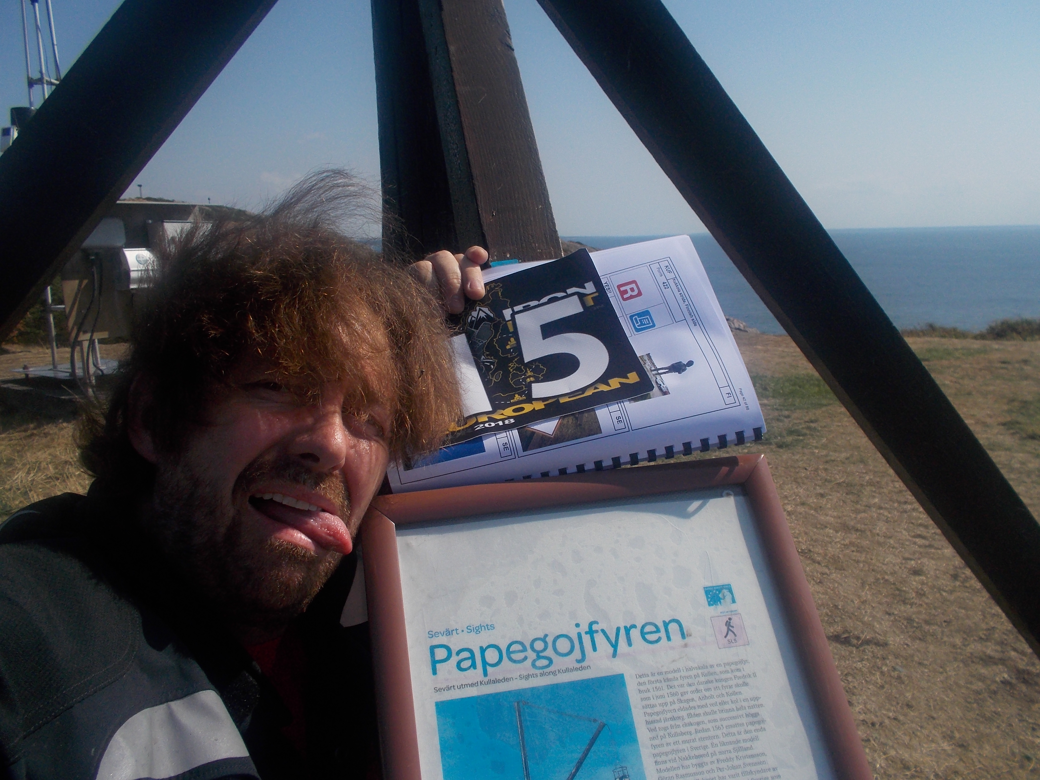
The next location was on the coastline again, a steel drum or something like that. Great weather, great view. The next stop was in Helsingborg, one of the few locations in a town. I stopped at a fountain and realised that it was in memory of Tycho Brahe, the great astronomer. I concluded that Helsingborg was a beautiful town and made a mental note about it. My trip along the coast was not finished yet, along some small roads I headed for a tip of land called Kullen. It was announced that there was a 400 m walk. A lot of traffic indicated that the place was very popular. As indicated by a GPS points, a road sign at a large parking suggested to leave the bike and to walk to the place of the “Fyr”, the fire place that served as a beacon in the old days. I left my helmet there, took off the jacket and strolled to the GPS location. After 300 m I noticed that some motorbikes did park near the beach. Hm, lucky ones. As the temperature was close to 30 degrees, my sweat started to flow in streams. Finally I reached the spot and tried to take the required selfie. Maybe I should buy me a selfie stick for these occasions. I had to be in the picture and this required several attempts.
After a sweaty return to the bike I continued my ride, hoping that the indicated petrol station would indeed exist. It did. However, I had a fight with the card terminal and needed to change pump twice to get some petrol.

I was happy when I joined the E20 again, going up north on the motorway now. In a certain attack of brilliance, I exited and hoped to find a Swedish souvenir at a petrol station. My good nose was right: I found a Swedish Elk that I baptised “Erich”. Second souvenir bagged. East of Göteborg, I had to do a little detour to take a picture of another natural park information panel. I was getting cooler know and the ride was more enjoyable. North of Göteborg, I visited the Bohus Castle.  Like everywhere else, I had to be very careful. The high points for the flex-combos allowed no mistakes as I was aiming for two big 14-locations-extra-points. I also have my instructions in my tank bag, but in this rally, like in the Ironbutt Rally, I looked up the instructions at every location. This helped me to prevent errors. So here in Bohus, I had to walk up to a panel and I had to be in the picture as well. Luckily, there was a girl I could ask for this favour. That’s why this is one of the “decent” pictures. I was well in time and decided to book a hotel as planned in the town of Karlstad for the night.
For the next hour, I was going up North on the E20. Time to switch on the radio to have some entertainment. Swedish radio can be quite ok at times, though it is often interrupted by lots of conversation that I could only follow in a very rudimentary way. In the westernmost Swedish town of Strömstad I took a picture of the hotel Skagerrak in the centre. From here it was only 15 minutes to the Norwegian border that I had crossed already one day earlier. I exited at the first exit and hoped to find an appropriate souvenir there. I walked into the shop and discovered immediately a furry little bear with a Norwegian flag on its chest. Perfect. I filled up petrol and as I was 50 minutes ahead of my schedule, I decided to have a little break with “dinner”. I ordered a pølse, i.e. a hot dog that I was munching while I put on warm clothes. The day had been hot, but the sun was going down and I expected a cool evening. After a generous 20 minute stop, I hit the road again, but I misinterpreted my GPS and went back south on the motorway. I had to turn around at the next exit for my sat nav had tried to tell me to turn right at the petrol station. Grmpf. Another 10 minutes lost. The evening ride through the Norwegian hilly landscape was a nice change and I enjoyed it very much. But before that, I discovered a Scandinavian phenomenon that was explained to me by a Swedish colleague after the trip. In the town of Halden, there lots and lots of US classic cars from the fifties and sixties with people often dressed in Rockabilly style. This slowed me down a lot as hundreds of cars were promenading through the city. It seems this was an organised meeting, the Grense Treff. Apparently, this is based on the subculture of Raggare. Interesting.
It was slowly getting dark, but I still had to take two pictures. The first one had still enough daylight to make a meaningful picture and the second was already in the dark. I was riding on backroads now but thanks to my illumination (Xenon low beam plus 2 x H7 high beam plus 2 x LED fog lights plus 2 x Clearwater Sevinas with 7500 lumen LED each), I turned night into day. This could be fun, but I have quite some respect for any kind of wildlife at night, and in Scandinavia it can get quite big! (hello Erich). So I was happy to get back on a main road and I arrived in Karlstad at a quarter past 11 p.m., perfectly in the time window to start the night rest. I got my first petrol receipt of the station close to the hotel and checked in. 1300 km on the first day, not bad. Unfortunately, the hotel reception had no proper food to sell, so my second dinner consisted of some crisps, a filled knäckebröd and a chocolate wafer which I had purchased with some discount as the receptionist felt sorry for not being able to provide me some proper food. At midnight, I had prepared everything for the next day and was in bed.
The alarm rang at 3:20 a.m. and after a very quick breakfast with coffee and a candy bar, I left the hotel 15 minutes later and got my second receipt documenting the 4.5 hour rest break. What a luxury! Half an hour more than required, but I thought that I had arrived 20 minutes before schedule the night before so I deserved some indulgence, LOL. But the true reason was that the next location in the morning required daylight so it made no sense to be there too early.
The hotel had been a very strategic location outside town and from here I had to turn north towards Filipstad. The daylight bonus location was an airfield that required riding on gravel roads. Usually, I trust my older Garmin Zumo 660 over the Zumo 590 when the routes diverge, but now it wanted to send me over barred gravel roads. Finally I arrived at the propeller that had to be in the picture. More gravel road and after a combination and applying some common sense in interpreting the GPS data I was back on the main road.

When I review my whereabouts during the next hours, I find some disturbing issues. I thought I had passed the town of Filipstad twice, but indeed I passed it three times. After the first passing-by, I visited a silver mine before I returned to Filipstad where I had to take a picture of a memorial that was located on a hill. When I went uphill, I realised that in was in the centre of a cemetery! But as it was only 5 a.m., there was nobody around to complain. It started to rain heavily in that moment, so I tried to take my picture quickly and leave the cemetery. When I went downhill, I noticed something strange. The bike would not respond properly and when I was back on the road, it had no power and some warning symbols in the dashboard were lit. Confused, I switch the bike off and on and it seemed to work again. On the way to the next location, it happened again. And again. Worried, I stopped at a parking next to a lake. There was little shelter from the rain, so I decided not to take out my bike manual, but to consult the internet about this problem. However, there was no phone coverage! OK, this was serious. I decided to try to get back to Filipstad, there would be a petrol station and better coverage. On the way there, the bike would stop once more, but after 10 km, I reached Filipstad again and parked under the roof of a petrol station. It was almost 6 a.m. now and the station was about to open; I explained the problem to the attendant and he invited me to the warmer inside of the station. I checked the manual and learned that the symbol meant that there was something wrong with the emission control and that it was not a very serious problem, this would have been indicated by other yellow or red symbols. There was no proper internet coverage, so I used the wifi of the station. However, I didn’t get any more useful information so I decided to continue. If it would get too bad, I could still try to limp back to the HQ, it was “only” some 300 km away…I switched on the BMW…..no warning message! OK, I had lost 55 min now, but let’s give this a try. I sensed that my “extra loop” to Luleå was under pressure. Some 15 minutes later, I realised how close I had been there before when I arrived at the next location. It took me some minutes to find the right spot as my Garmins insisted to send me by a “shortcut” where there was no road. Finally, I found the memorial for John Ericsson’s birthplace and left happily. In retrospect, I almost committed a terrible mistake there: nasty rally masters, me included, have the tendency to choose two locations that are very close together so that one can be overlooked during planning if the route is not checked in high resolution. It was a location just some meters away and of the some category! What a mistake!

For the next 90 minutes, I only had to ride through sylvan Swedish countryside until I reached Mora. The last 50 m to the Langlauf statue I had to walk, obviously preparations for a sport competition were on the way. The statue remembered the famous Vasa Run that ends in Mora. The rain continued and the fine drizzle got stronger and stronger. It was only 13 degrees warm, but the temperature would not rise….I rode another hour through the forest until I reached the old cobalt mine of Loos. It reminded me of the long history of metallurgy in Sweden. Suddenly the forest changed and looked….burnt! I realised that I was passing an area where some days ago the large forest fires raged. All the under-brush was burnt, only some of the high pipe tops were still green. A bizarre sight.
In Ytterhogdal, I took a picture of an iron statue of a blacksmith. Did I already mention that it was raining? The temperature did not want to rise. 40 minutes later at 11 a.m., I had enough of the cold and the rain. I had to stop for petrol and I decided to change the fleece jacket for the heated Gerbing jacket. I noticed that water had already entered the gear, probably by the collar. I permitted myself the luxury of a quick second breakfast, still shivering. But then I enjoyed the warmth of the jacket. What a delight! I still felt very damp, be at least my body temperature and mood started to rise again. I felt content about the fact that I had tested the K1600GT in this kind of weather and bought it also for this feeling of safety under slippery conditions. I made good progress and at 1 p.m. I took a turn from the E45. After 20 km of bumpy road I took another turn. I ignored the Garmin’s advice to use a steep gravel “shortcut” and followed 4 km of even more bumpy road. Then I did have to turn on a gravel mountain road. Did I mention it was raining? Gravel was ok, but partly the track was also slippery. The sat navs told me to stay on this road for 4 km. Fantastic. On the top of the mountain, I knew I had to park the bike somewhere and walk 400 m to the very top. Luckily the GPS locations were very exact in this rally. Very much appreciated in these remote places… I finally reached the clearing where the GPS point was. From the rally book, I only knew that I had to take a picture of a kind of balcony….but then, I spotted this between the clouds and mist…

What??? I had to take a picture on the top??? Bast…..!!!!! The stairs were steep and wet. Did I already mention it was raining? And on a mountain top, you get also the wind. I grabbed the rally flag and rally book in one hand, stored the camera and GPS in my jackets and started the ascent with one free arm. Holy crap, this stuff was slippery! This was impressive. When I finally reached the platform, I was afraid that the wind would blow away my book or flag. I managed to take a decent picture after several attempts. There was no time for enjoying the non-existent beautiful panoramic view….just get down from this bloody tower! But as it is with climbing, it might be easy to get up, but it can be more tricky to get down…
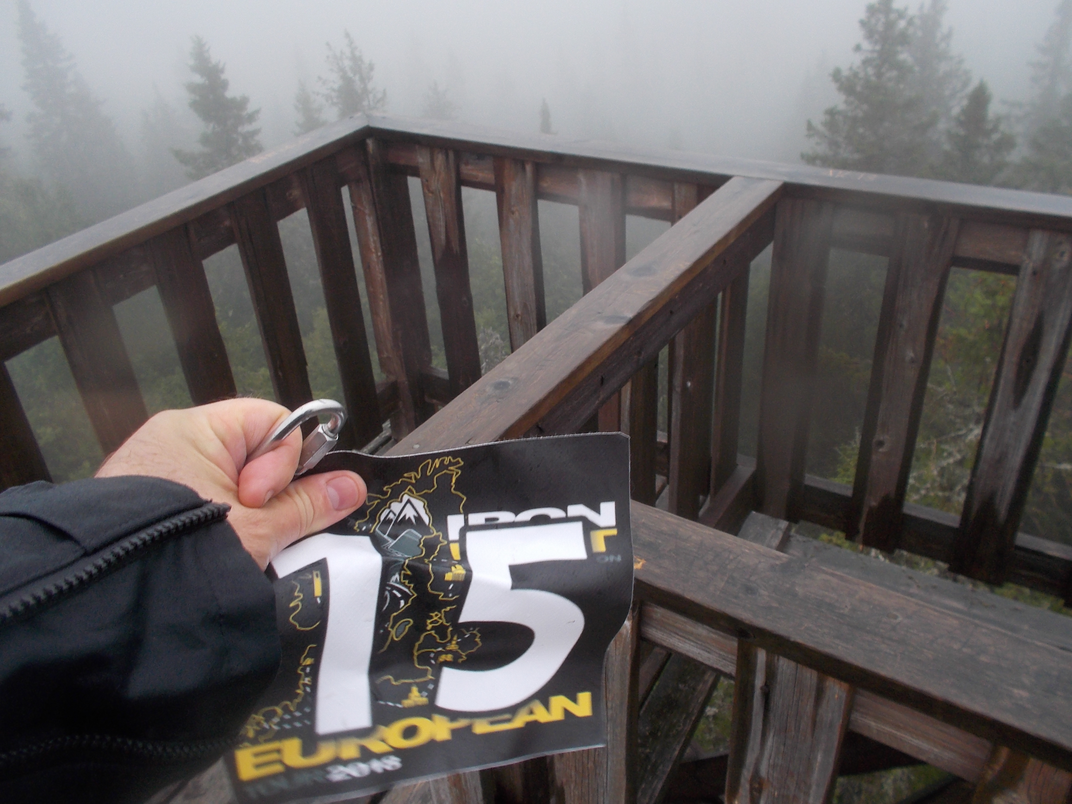
I went down in the same way I went up, facing the stairs. One step at a time. Did I already mention that the stairs were fecking slippery?
Phew! This was done. I strolled back to the bike and went down the gravel road. Veeeery carefully. It would be stupid dropping the bike here. When I rode back on the bumpy road I concluded that under these conditions, this was one of the most tricky locations I ever visited in a rally. I mean, riding up a mountain on a gravel road. And walk to the top. And climb on a tower. But a great memory.

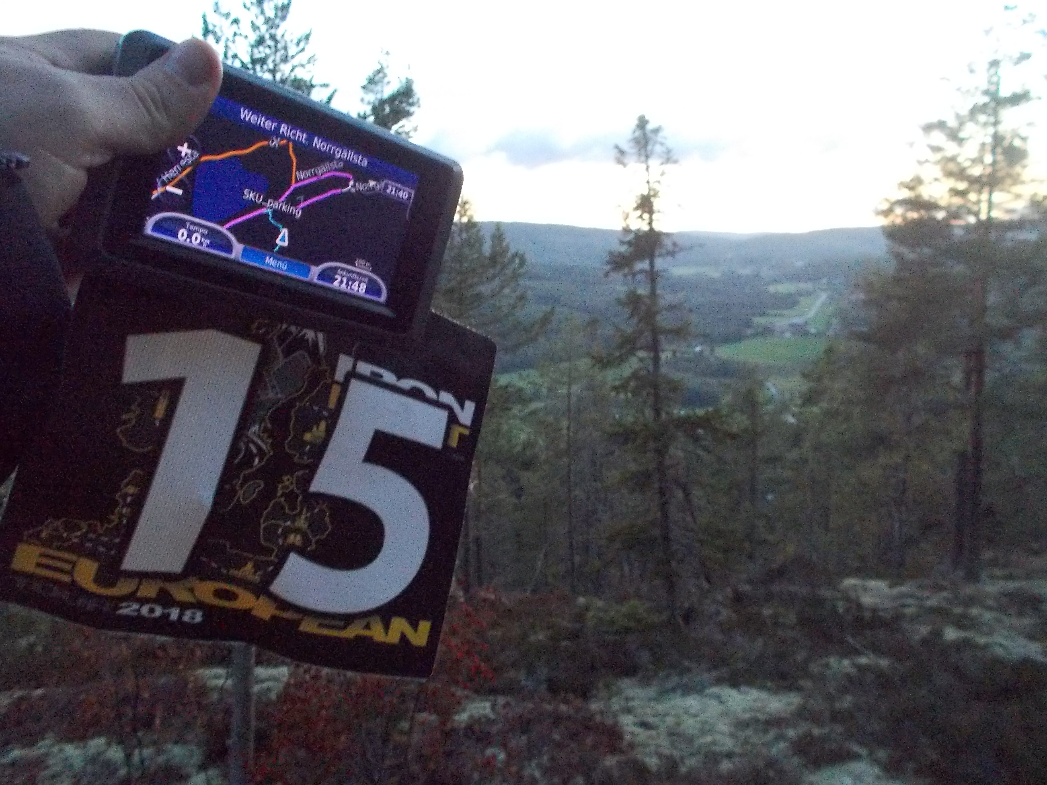
Soon after I was back on the E45, I passed some drenched Italian bikers and then I saw this sign. Lappland? Was I already up that north? The sign said yes. I had the feeling that the rain got stronger and stronger. For the next hour and half: forest, forest, forest. Then finally I reached the next bonus point location near Storuman. It had to be a kind of log hut on a pole. It took a while to find it but then I had found it. It was still raining continuously and although I felt warm, I could feel that I water had entered my gear from the top. My feet also felt a bit wet as I had stopped in places where I had to put down my feet in large puddles. My gloves were totally damp, despite the hot heated grips. I was 70 minutes behind my plan. I had planned to take a decision in Storuman whether I could do the extra loop via Luleå. I decided to look for a petrol station and to assess the possibilities. But first I visited a small location in Storuman. I stopped at the only petrol station and filled up as I didn’t want to stop for petrol anymore on that day. I entered the station and met two other German riders that were also trying to find out what do to. They came from the North and were soaked as well. I sat down, had a sandwich and used my laptop to check the options. After the break, I would be almost two hours behind my plan. The extra loop was based on three buffer hours, I had already spent two of them. This didn’t look very good. But the main concern was that with this weather, I did not want to ride on back roads to Luleå. I preferred to ride on the main road towards Umeå and hoped that the rain would stop at the coast and that temperatures would go up. I just wanted to find accommodation for the night. This turned out to be difficult because all available hotels in the vicinity of Kramfors required arrival before 9 p.m. Impossible. So there was no other possibility than to make a detour and stay in a hotel in Härnösand. Right. Booked. However, as I had to visit one location just around sunset, there was no time to lose. I had decided to play it safe and continued on the E12 towards the coast. Indeed the rain slowly vanished and the temperature went up degree by degree. The fun came back.
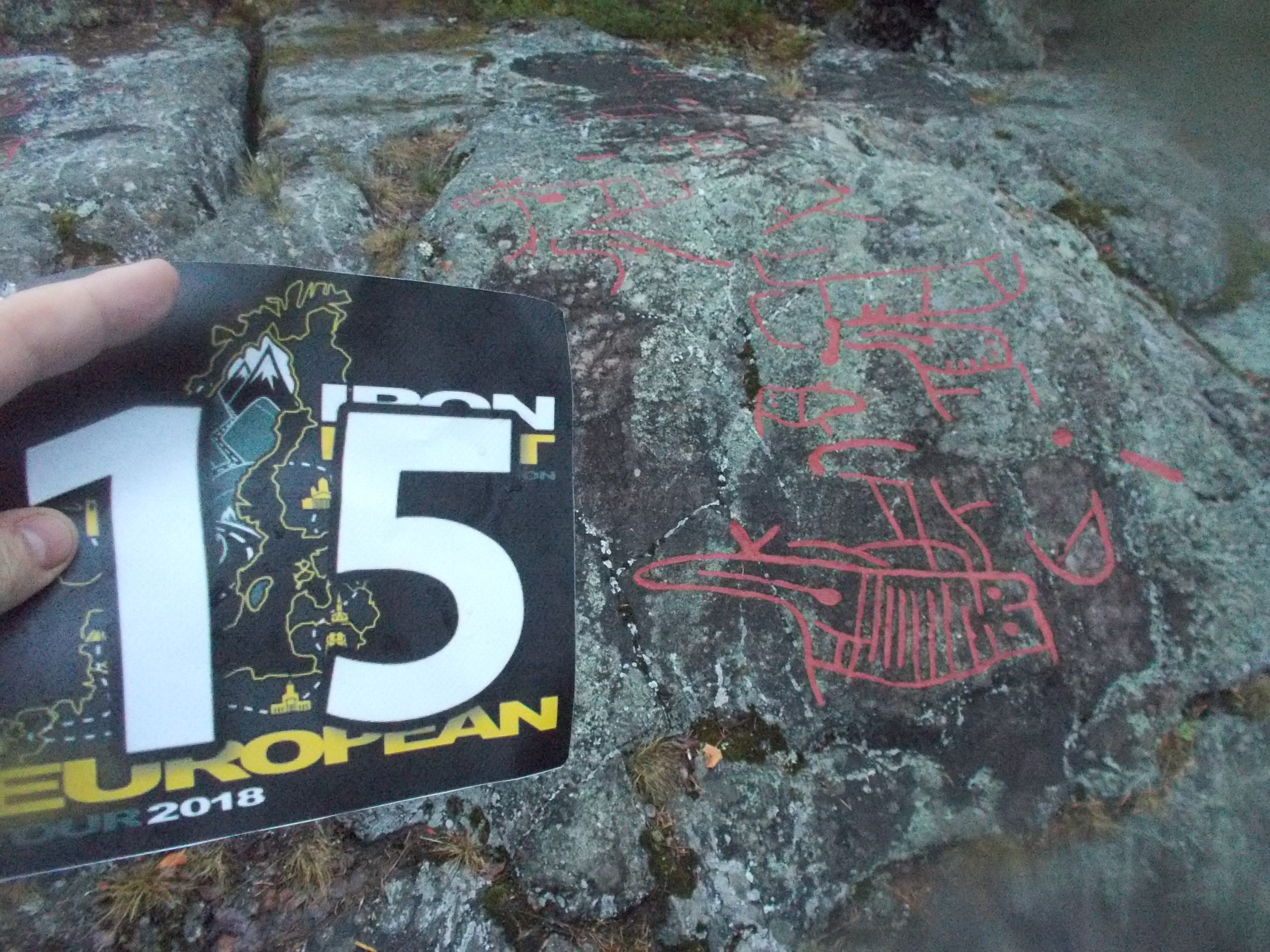
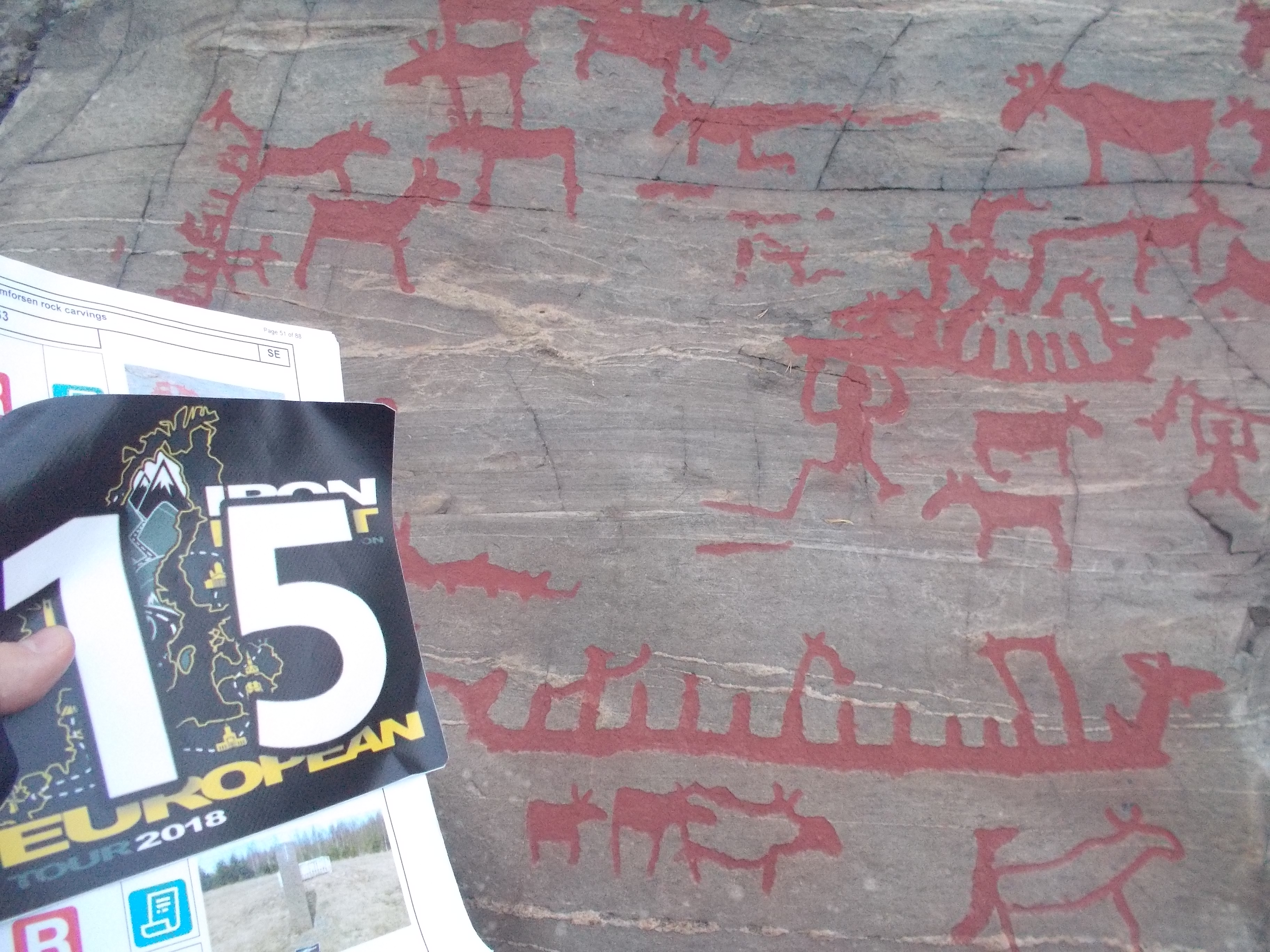
After more than two hours, I reached the next location, a place where I had to take a picture of prehistoric stone carvings. However, I was confused. The GPS point was 100 m from the parking and it took a while until I realised that I had to walk down the hill and a wooden runway along a river. The carvings were of course at the end of the long runway. I had lost some time here and needed to speed up now, the location at sunset hung like a sword of Damocles over my head. I needed to bag this point today, otherwise I would lose a lot of time the next day. I needed to go a bit north for the next point (a yellow cabin) and back to Umeå. I was on the E4, the long North-South motorway through Sweden. In this part, however, there were mostly only three lanes so trucks were slowing everybody down. Nevertheless I could gain some time and it seemed more and more realistic that I could reach the next point just around sunset. My sat nav told me that there was a parking position and the GPS coordinates were somewhat away from that point so I deduced that I had to walk a bit. The location was closely to the E4 and I reached the place right after official sunset time. But no problem, there would still plenty of time to take an official ‘daylight’ picture, wouldn’t it?
At the parking position, I looked around….so this was a chair lift….hmmm….the point seemed to be on the top of this “hill”….hmmm….but the rally book said nothing of a walk. Then it must be nearby. I followed the signs “Toppen” (the top), carrying my camera, flag and GPS. It was a steep path through the forest, as it was already late, I was more running than walking. I started to swear…this was clearly not close to the parking position….there could have been a clear message in the rally book! Luckily the blue marks were very clear, otherwise you could get easily lost. At a certain point I was about to hyperventilate. I forced myself to slow down a bit, I needed to get some air in my lungs…after 15 minutes, I stood there panting….this was not possible….instead getting closer to the target, I was moving away from it!

There was something wrong. I was on the wrong track. But there was something going on here. There were no instructions in the rally book. This was no hill, this was a mountain! It started to get dark! I needed to turn around before it was too late to see the track!
I decided to take a selfie with the flag and to return. I had done some 150 height metres in just 15 minutes. This was the double speed of a good hiking pace. In motorbike gear! I was exhausted. I realised I had left my mobile phone in the tank bag. Great. No phone, no light. So, better get down quickly! But better be careful, if you would slip and hurt yourself, nobody would find you until the next morning….if at all! But finally I was back at the bike. I took some additional pictures from the signs and the area. When I could breath normal again, I called the rally master. This was a disaster, but I wanted to have the points! When I explained the situation, Benny explained that there had been an error in the rally book. It should have been mentioned that one had to go with the chair lift inside restricted hours. However this information was missing. …..[…]…..OK, but do I get the points??? The answer was yes, so all of this was not in vain. I noticed that I had lost the electric cable for the heated jacket at the carvings point….superb. I hoped I wouldn’t need the Gerbing jacket any more on this trip.

I was dark now and I was happy that I had a booked hotel room and only needed to ride 50 minutes on the E4. Petrol station ticket and ready for check-in. It was about 11 p.m., just the right time. Another 1500 km ridden. When I entered the lobby of the hotel, I took off my helmet and opened my jacket. There was a stinging smell….where did this come from…slowly it sunk in that the source for this smell pollution was nobody else than me….this was no surprise….I was soaked for half the day and even after drying, I maintained the notorious “wet dog” smell. And then I had run up a mountain and was drenched in my own sweat. An explosive combination. The two ladies at the reception professionally kept their countenance. As the day before, no proper food, my dinner would consist of wafers, apples and candy bars. When I entered my room, I ripped off my clothes and put everything on hangers to dry a bit during the next three hours. I decided to take a full shower, I couldn’t stand the smell of me. ’nuff said. After that, I had “dinner” and checked my route for the next day. The weather forecast looked good. The alarm was set on 3 a.m.
I was on the road by 3:30 a.m. Another petrol ticket and I was going back north to the first bonus point location. Half an hour later I was there. The next location was called Häxberget where I had to take a picture of two memorial rocks. It was the place where in 1675, 71 persons were accused of witchcraft and burnt on this site. Unbelievable.
I needed to go westwards into central Sweden, forest, forest forest. After one hour, I reached another river where I had to take a picture of another rock carvings. When I walked across the site, I realised that I had to find a very specific carving. Tricky! But in the end I found the right place. Up, up and away! I was ahead of my plan, this looked good! The next location was another hour away….more forest! I was a nice morning ride, I made good progress and the landscape was nice. My excursion to central Sweden was not so bad. When I rolled on the parking of the Döda Fallet, an official exited his car to see what bike entered the place so early in the morning. I realised this would be another walk again and grabbed my stuff. I passed the guy with a friendly “God Morgon” and I could see how his brain was trying to process all the information. I had to walk down a hill and take a picture of a platform with a beautiful view.

Back to the bike, pffffff….good morning work-out. From then on the clouds disappeared and now I was riding under a beautiful blue morning sky. Great views! This was compensating for the wet day before! The euphoria lasted for half an hour, until I had to turn from the main road 86 in Liden. Hey, this was a gravel road! It will stop soon….1 km….2 km…5 km…hmmmm…the GPS indicated the next stop in 76 km….I hope this won’t all be gravel???…..10 km….come on!….15 km….bloody gravel!…..tarmac! there’s tarmac! In the end, I didn’t drop the bike, my autosuggestion worked well, it is mumbling “arrive! arrive! arrive!” which means I am virtually kicking myself in the ass reminding me not to do anything stupid.
In the end I followed a narrow road uphill. I parked the bike and walked to the wooden construction on the hill…ah, so this was the centre of Sweden. Sometimes it ‘s a pity not to have time to read the rally book in advance.

Right, now it was time to get back to the coast. I was well on schedule and soon I could join the E4 again. I thought that I had time to fill up and a quick breakfast around 9 a.m., after all, I had been riding for more than five hours already. The traffic was flowing well on the way south. There were bonus point locations to the left and right, but they didn’t fit into my plan. Good rally planning asks for sacrificing time-costly, low-points locations. It was a nice sunny and warm day again. Close to Gävle, I had to exit the E4 and head for the Fjärnebofjärd. I visited a nice, quiet place next to the river and took my picture of the wooden pier. The rally master was very strict and insisted that, should the rally book not ask for the rider to be in the picture, nobody else should be in the picture. So I had to ask two tourists to leave the platform. Sorry.
The next location was in Uppsala, the famous university town. It was a bit tricky to get close to the picture point as most roads in the university district were for pedestrians only. But finally I found the right spot and took a picture of the university church tower. The temperatures were high now and I was happy that I could take off some of the warm clothes now.
The next target was Stockholm. By that time, I was something like three hours behind my initial plan, but I still had three hours of buffer. However, I knew that some rain would come in the evening, so I wanted to save time. I decided to leave out Ytterby, east of Stockholm. I knew it was part of a smaller combo flex worth merely 1500 points, but I preferred to gain some extra time. I wanted to visit three additional places in Stockholm instead that were next to my planned route. The first stop was an installation in the atrium of the university, the second was a clock in a pedestrian zone in the centre (very tricky to get to), the third a big “ball” building with elevators on the outside. Here I lost some until I realised I had to walk to take the picture. The last stop was a park that is also a UNESCO heritage. Good, this was the maximum “traffic” I would get on this rally. Piece of cake. I went to the south of Stockholm where I took a picture of a place that once had been the first Swedish nuclear reactor. Next was a rune stone. Suddenly I realised that of lot of motorbikers were on this nice road east of Södertälje. And they were not going like typical Swedish bikers…no, they were going at full throttle! Bizarre. Suddenly my journey came to a halt. “Take the ferry”, my GPS told me. I realised that both GPS thought it’s not a good idea to take the easy road around the Himmerfjärden, but a ferry that runs every 30 minutes. Great. A break of 20 min plus the 5 min ferry trip. I felt somehow weak and a bit sluggish. Then I realised that I had no food since my “breakfast” more than six hours ago. I just needed some food, that was all. But first, I had to do another walkie down at the sea: At the Stendörren nature reserve, I had to walk to a bridge take a picture of it. From the correct side.  Good, this was achieved, but I needed food. But first a trip to the Uppsa Kulle, a 55 m wide, round ancient grave that I simply took for a hill. But finally I found food in a petrol station. That was better. For a quick moment, I joined the E4 again and went south on the E22 towards Västervik. The weather forecast had been very accurate and just before the Town, the thunderstorm started. When I rolled through Västervik, I remembered that I forgot about the two text-in bonus that were scheduled for that day. When I stopped at the bonus point location and consulted the rally book, I found out that I had missed both time slots for the day. A stupid mistake! Usually I add this in my to-do-list, but forgot to add it last night. Maybe I had been stunned by the smell.
OK, so I took my picture of the beacon’s door and started the my approach to the last important location of today. I “only” had to head west towards Jönköpping with some detour to the north. It was raining, but I knew that my plan had worked, I just needed to get to the rally hotel, spend my rest break there, and visit two more places in the morning before the finish line. Easy peasy, but I had learned that the rally ain’t over before it ain’t over. Hold your horses. I rode through a wet forest when my GPS had me turn on the road to the last BP. I passed a sign that said something of a ferry… looked at the GPS and saw at the top of the screen: “take ferry”, next to the distance of 9 km. WHAT? I stopped and zoomed in and out. Yes, Just before the location, I had to take a ferry! Bloody hell! Had I known this, I had taken a different route (I should have selected “avoid ferries” in the GPS). I turned around and studied the sign….ferry operating until 10 p.m. Hmmm, it was 8 p.m. now…that could work. And it made no sense to go around the large Sommen lake. OK, let’s do it! I arrived at 8:10 at the lake….the ferry was not far away, but on the other side.
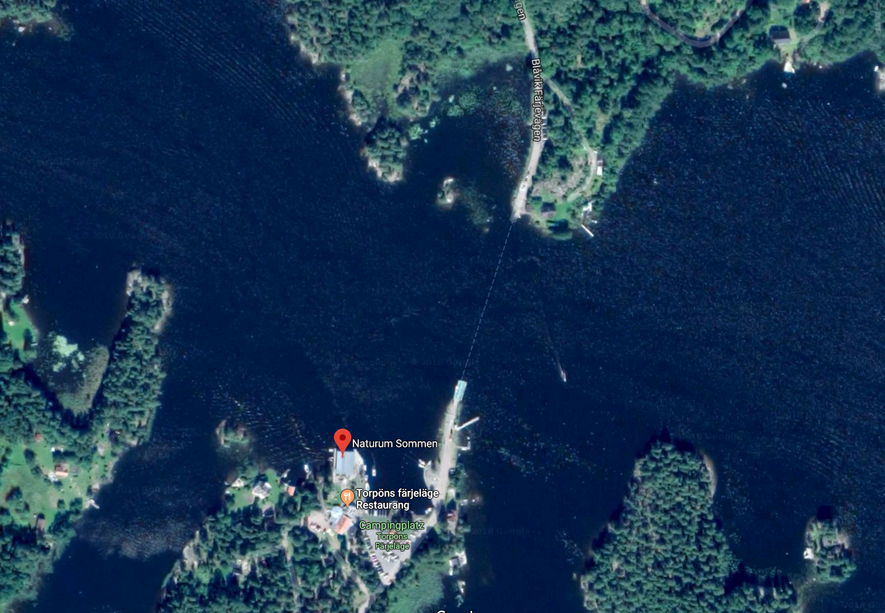
Hmmmm, how did this work. “Push this button to call the ferry”. No reaction. Then I studied all the papers on a board. Ferry operates every 30 minutes. Hm, 20 minutes to go. This gave me the opportunity to make a phone call, put on warm clothes and empty my bladder. At 8:30, the boat would start the engine and slowly move to this side of the shore. Finally I got to the other side and visited the bonus point location that was right there, a cow sculpture. The tricky thing was that I needed several attempts, maybe I should buy a selfie stick for this.
Ok, so I “only” had to get to the hotel, maybe pick some two smaller bonuses close to the hotel. This would take me some estimated one hour and a half. It was getting dark, the road was wet and winding.Take it easy, there’s no need to rush. Suddenly, the “emission control” warning lamp came on again and the power was gone. WHAT? I stopped, switched the bike off and on and continued. But only for one mile. The bike stopped again. You feel that Mr Panic has awoken in the cellar and is about to come upstairs. What is the matter??? I repeated this game two more times. It wasn’t raining now….what was in common with the incident the day before?…..Wait, in both cases I was going downhill when it first appeared….and then I also remembered that two times the bike sputtered a bit when I had just filled up and had not closed the shut-off valve of the auxiliary tank. Could this be related? I looked at the fuel gauge…the main tank was completely full. Could it be that it was overflowing? Would it stop again when I closed the open valve? Let’s try…..In the meantime, Mr Panic was already at the first floor….I closed the valve and at the same time, the bike stopped again. Well, this could be coincidence….try again. And from this point on, Mr Panic disappeared and was not seen any more on this rally. This was it! I don’t know how to explain it, but the overflowing main tank must trigger an electronic warning that sets off the emergency programme. What a relief! The root cause was that I had opened the auxiliary tank too early in both cases. Problem solved.
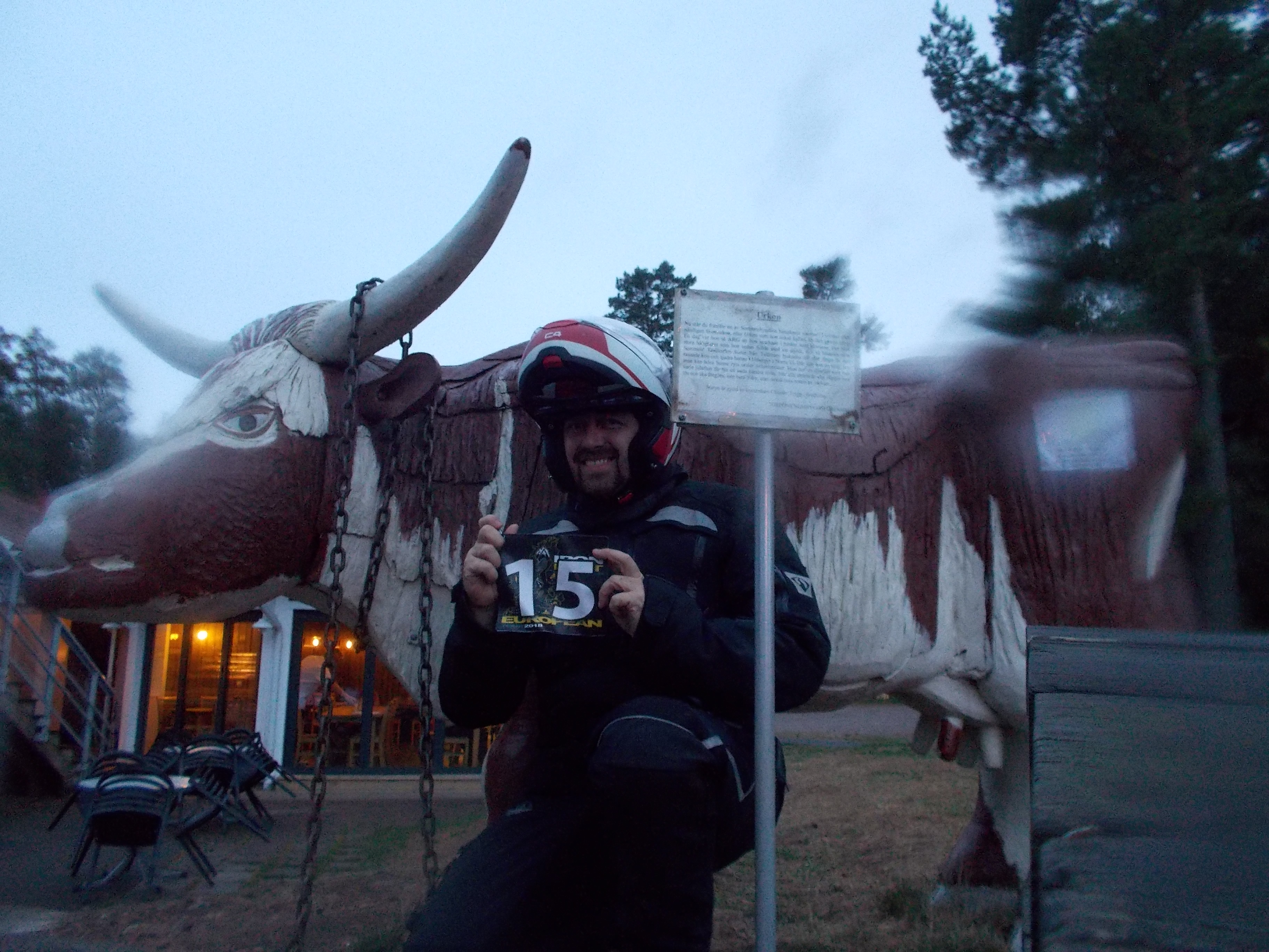
But in rallies, you solve one problem and you encounter another. In Tranås, I ran into another “bilträff”, i.e. car meeting. The same story. But this time, the main road was closed so the old rust buckets could go in circles. I had some trouble to find my way around the city. Finally I arrived at the Vättern Lake and went on the E4 towards Jönköping. Close to the hotel, there were two small locations that I wanted to visit. The first one was an illuminated wooden giant and the second one a sea monster. Unfortunately, I was supposed to take a selfie there, but I didn’t manage in the dark. I decided to come back the next morning. I got my rest break fuel stop receipt and at 10:30 p.m., I rode on the rally HQ hotel parking. To my surprise, many other riders were already parking there. Had they already finished their ride? I still had work to do, for I had to visit two locations that would give me two 14th locations that were worth 20.000 extra points each. I checked in and bought a salad and a sandwich, said hello to other riders and entered my room. What a great idea to stay here! I could just return in the morning, have a shower and have a little nap before leaving for the ferry. I checked again my plan for the morning and prepared my claiming sheet. It made no sense to leave too early, the two locations were daylight bonuses. I decided to go first to the one farthest away.

I left around 3:30 a.m., got my last rest break ticket and went westwards. It was still pitch dark, there was some drizzle and I was happy to have my Sevina lights that turn night into day. I permanently told myself to keep the speed down, there was no point in risking anything such as overtaking trucks. I had enough time and I just needed to stay patient. One and a half hours later, I arrived at this Hornborgasjön visitor centre, however, here in the south, sunrise was later than in the north, so it was still a tad too dark to take a “daylight” picture. I parked the bike and made use of the public toilet.

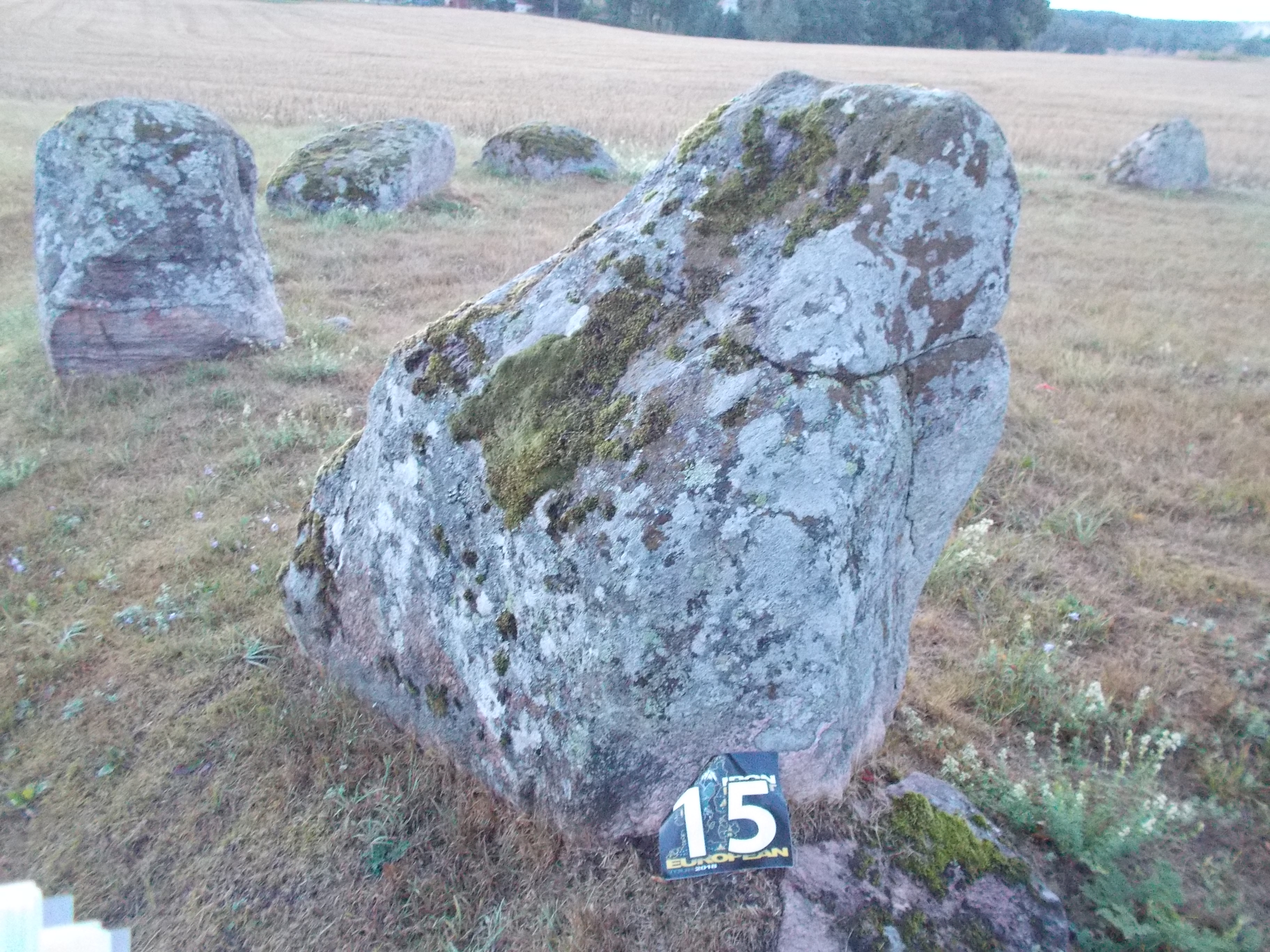 When I stepped out again, I was surprised to see that it was so much brighter now and I could go and visit the picture point. I found the pier and took my picture. Yes! Now for the last big location. After 30 minutes, I arrived at some stone ring and took my second 20.000 points picture of the morning. My big plan had worked! I just had to ride back to Jönköping. No hurry! Enjoy the last kilometres. I still had time to visit the happy sea monster in Huskvarna and took my final picture. I was one hour early and would even have enough time to push back the bike in the worst case. I arrived at the HQ, checked in and the rally was over for me. I had breakfast and left my stuff in the room and went with my documentation to the scoring room where I had to present my claiming sheet and pictures to my two scorers Hampe and Jens-Olof. Two strict scorers, gulp! I had forgotten to introduce one mileage for one location and lost 80 points, no problem. The clock in Stockholm was supposed to be a selfie, ok, no points for that. Then there was a discussion about the Hornborgasjön picture. It turned out that the picture in the rally book was taken from a different angle; as the house was symmetrical, it looked almost identical, only the pier in the foreground was somewhat different. I protested, this picture was worth 10.000 points! The rally master took a wise decision: the picture was basically the same as in the rally book and proof that I had visited the place as it was the intention. Phew! Then there was another issue that I had claimed more points for a 8 locations combo flex, however, I had only visited 7; that makes 3000 instead 10000 extra points. I could not visit the 8th one as it was a daylight bonus during the night. Maybe I had also counted with the extra loop on day three. Well, more than 74000 points sounded a lot and I had only lost about 200 points. I had forgotten the text-in bonuses and left out the Ytterby BP, which means I would have had 3000 points more. And then I did not do the extra loop to Luleå. Without the problem in Filipstad and the rain, I would have done it, securing me the 10.000 instead the 3.000 extra points. But again, 74.000 points was something to be happy with.
I went back to my room, had a shower and a nap. Then I packed my luggage, put it on the bike and checked out the room. Then it was a long wait in front of the scoring room. A lot of time to chat with other riders and to exchange anecdotes. Finally we were called in and waited with anticipation. Some riders had crossed the Baltic Sea, some ran into troubles while photographing nuclear installations…
Well the ceremony went quick and in the end, only three riders were left…

Scott on third position, what a surprise! Then there were only two…

What a route! Up to Norway and back! More than 72000 thousand points! Wow!
But then there was only one rider left…

Oops, I did it again…. What a nice rally! Thanks to all the organisers, the helpers, the scouts. Well prepared and executed! It was a pleasure.
Epilogue
Right after the ceremony, I had to leave to get to the ferry in Trelleborg. I had more than one hour of buffer, but I preferred not to be in a hurry for a change. I said goodbye and went down the E4 again. More or less half way, I stopped for a fuel stop. Shortly after, the bike lost power and a warning message came on! WHAT!!?? AGAIN??

But this time it was different, the symbol was not the ’emission system’, but the motor symbol itself, plus the yellow warning sign. I switched off and on…and it worked! I accelerated….and stopped. I accelerated more carefully and by using the cruise control, I increased the speed incrementally. It would stop at 105 km/h again. OK, I still had 150 km to go and three hours to the ferry left. I decided to roll at some 93 km/h. A totally different experience. This worked. With some 50 kilometres to go, it stopped again and I lowered the speed to 85 km/h. I was slow, but I was rolling. Please, please, please get me to the ferry and on the boat! Tomorrow is another day, I could visit garages around Hamburg…
I crossed all my imaginary fingers and got closer and closer to Trelleborg. The motorway ended and just before a roundabout, the bike stopped again. It still rolled through the roundabout, but then I tried to do the same thing again, switching it off and on. But this time the error wouldn’t go away and the motor was only turning in idle speed. Aaaaargh! It was only 7 km to the ferry! Well, I had no choice: I started to roll in first gear and switched bit by bit to sixth gear. The bike rolled with some 30 km/h. Like a moped. But I got closer and closer to the harbour. 6, 5, 4, 3 kilometres….this could work!…2, 1….there it is! I checked in and rode through the harbour. This was a challenge, as I had no accelerating power, it had to be done by the idle revs that slowly pushed the bike forward. But the biggest problem was still ahead: the ramp up on the boat deck! However, the bike’s motor has so much torque that it chugged up that ramp without missing a beat. I was on the boat! I parked the bike and carried my stuff to my cabin. There, I immediately called the number of the BMW mobility card. As it was a Belgian number, I could chose between Dutch, French and German. Let’s try German. I had an operator whose first language was obviously not German, but we managed to address the issue. He promised me that the next morning, the ADAC would be waiting for me at the harbour. If they could not help, further steps would be taken from there. Good. That was all I could do for now.
I had my buffet dinner when I remembered that I hadn’t switched off the alarm on the bike. I rushed down to (still open) car deck and brought this in order. Back to dinner. That was it. The next morning, I had an early breakfast and when we were about to reach the harbour, I was called by the ADAC guy and we arranged a meeting point. This time, I was ready when the boat opened its bow. I rolled down the ramp and I saw the yellow car waiting for me at the harbour exit.
 He immediately started the diagnosis and connected his computer to the OBD connector. “Faulty throttle sensor signal”….oh dear…..this didn’t sound very good. I saw myself riding back home in a train. He muttered something to himself and checked the throttle. “Is it working now?” yes, YES! But what…?
It was the cable connector between the throttle and the harness, it had some play and did not deliver the ride-by-wire signal of the throttle position to the system. A zip tie solved the issue. Incredible. What a guy. Thanks a lot!
I filled up the bike again and started my trip back home. I arrived well in the afternoon. No problems.
A great rally and some fantastic vacations! We had a great time.

Leave a comment